MyTopo
Tennessee Colony Texas US Topo Map
Couldn't load pickup availability
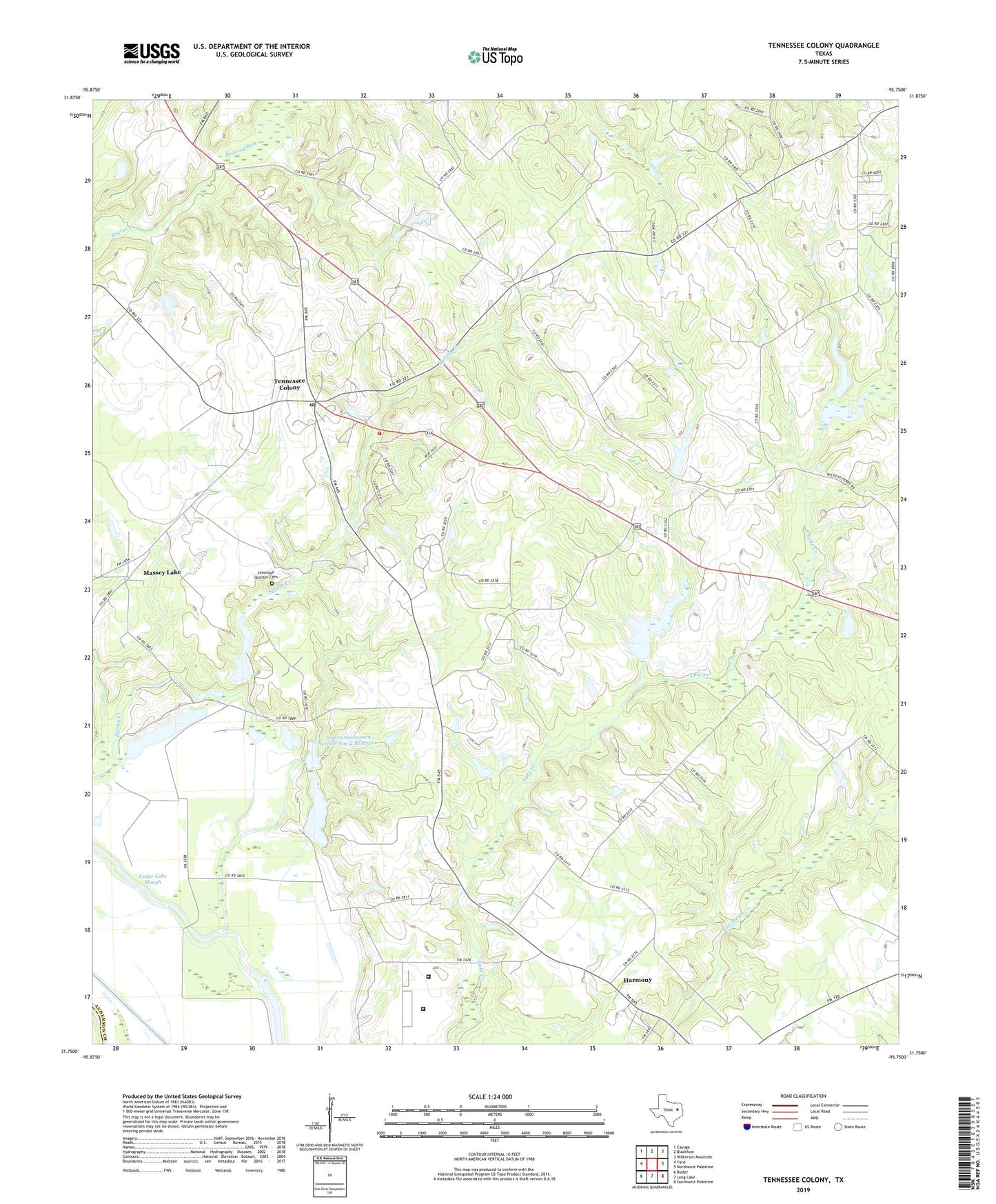
2022 topographic map quadrangle Tennessee Colony in the state of Texas. Scale: 1:24000. Based on the newly updated USGS 7.5' US Topo map series, this map is in the following counties: Anderson, Freestone. The map contains contour data, water features, and other items you are used to seeing on USGS maps, but also has updated roads and other features. This is the next generation of topographic maps. Printed on high-quality waterproof paper with UV fade-resistant inks.
Quads adjacent to this one:
West: Yard
Northwest: Cayuga
North: Blackfoot
Northeast: Wilkerson Mountain
East: Northwest Palestine
Southeast: Southwest Palestine
South: Long Lake
Southwest: Butler
This map covers the same area as the classic USGS quad with code o31095g7.
Contains the following named places: Carroll Lake Dam, Cedar Lake Slough, Clear Lake, Harmony, Highway Church, Jimmison Quarter Cemetery, Massey Lake, Providence School, Saint John Church, Snag Lake, Soil Conservation Service Site 1 Dam, Soil Conservation Service Site 1 Reservoir, Soil Conservation Service Site 2 Dam, Soil Conservation Service Site 2 Reservoir, Spring Lake, Tennessee Colony, Tennessee Colony Post Office, Tennessee Colony Volunteer Fire Department, Texas Department of Criminal Justice George Beto Unit, Texas Department of Criminal Justice Joe F Gurney Transfer Facility, Union Church