MyTopo
Spade Ranch Texas US Topo Map
Couldn't load pickup availability
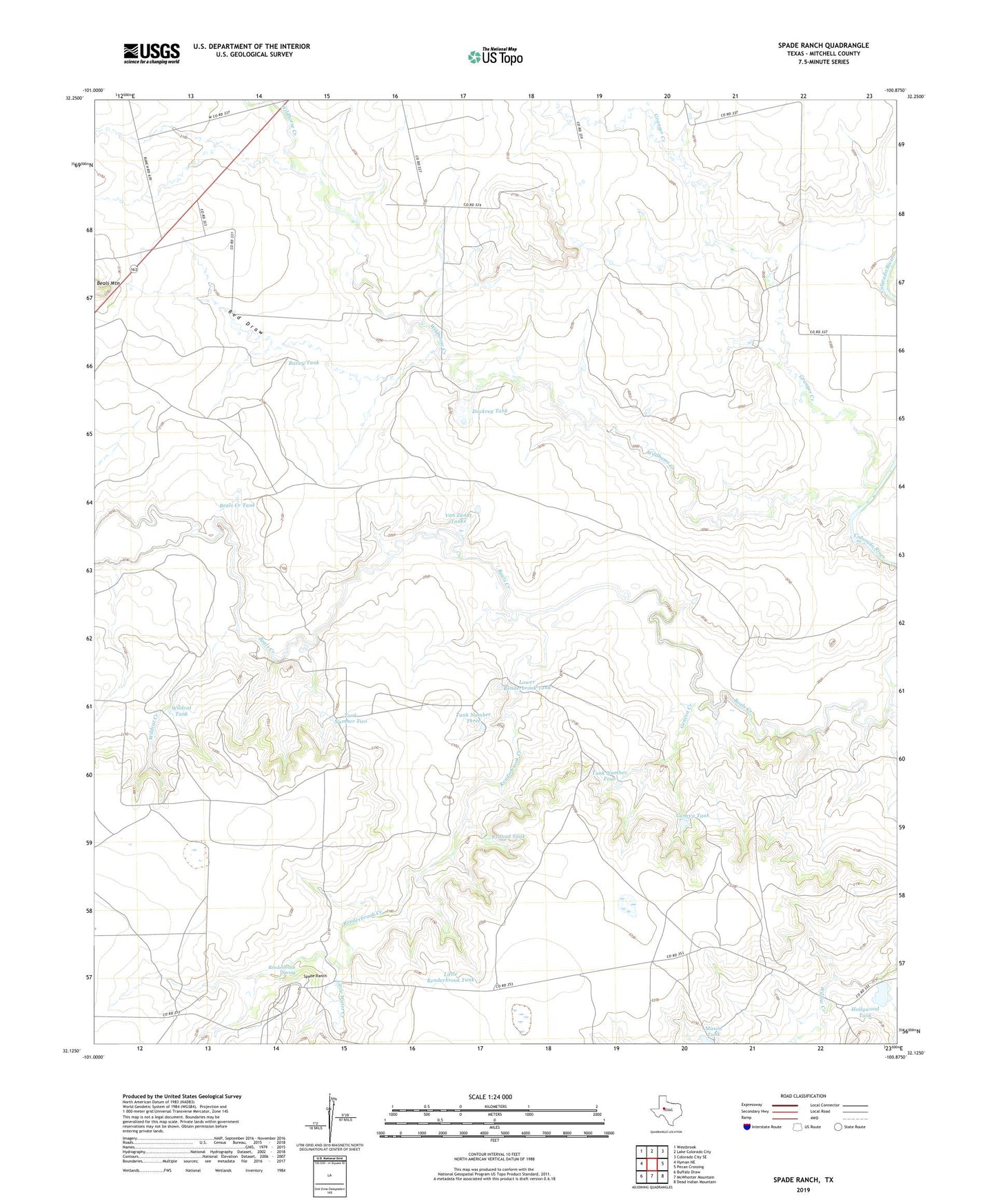
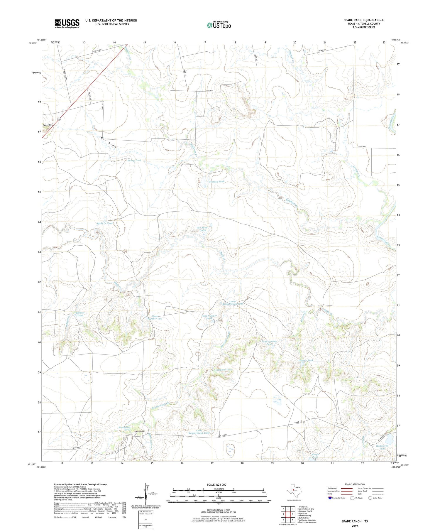
2019 topographic map quadrangle Spade Ranch in the state of Texas. Scale: 1:24000. Based on the newly updated USGS 7.5' US Topo map series, this map is in the following counties: Mitchell. The map contains contour data, water features, and other items you are used to seeing on USGS maps, but also has updated roads and other features. This is the next generation of topographic maps. Printed on high-quality waterproof paper with UV fade-resistant inks.
Quads adjacent to this one:
West: Hyman NE
Northwest: Westbrook
North: Lake Colorado City
Northeast: Colorado City SE
East: Pecan Crossing
Southeast: Dead Indian Mountain
South: McWhorter Mountain
Southwest: Buffalo Draw
Contains the following named places: Bailey Tank, Beals Creek Tank, Beals Mountain, Dockrey Tank, Dockrey Tank Dam, Geneva Creek, Geneva Tank, Granger Creek, Hollywood Tank, Little Renderbrook Tank, Little Water Creek, Lower Renderbrook Tank, Mason Tank, Mud Spring Windmill, Red Draw, Redbud Tank, Renderbrook Creek, Renderbrook Spring, Spade Ranch, Spade Ranch Hollywood Tank Dam, Tank Number Four, Tank Number Three, Tank Number Two, Van Zandt Tanks, Wildcat Creek, Wildcat Tank, Wildcat Windmill, Wildhorse Creek