MyTopo
McWhorter Mountain Texas US Topo Map
Couldn't load pickup availability
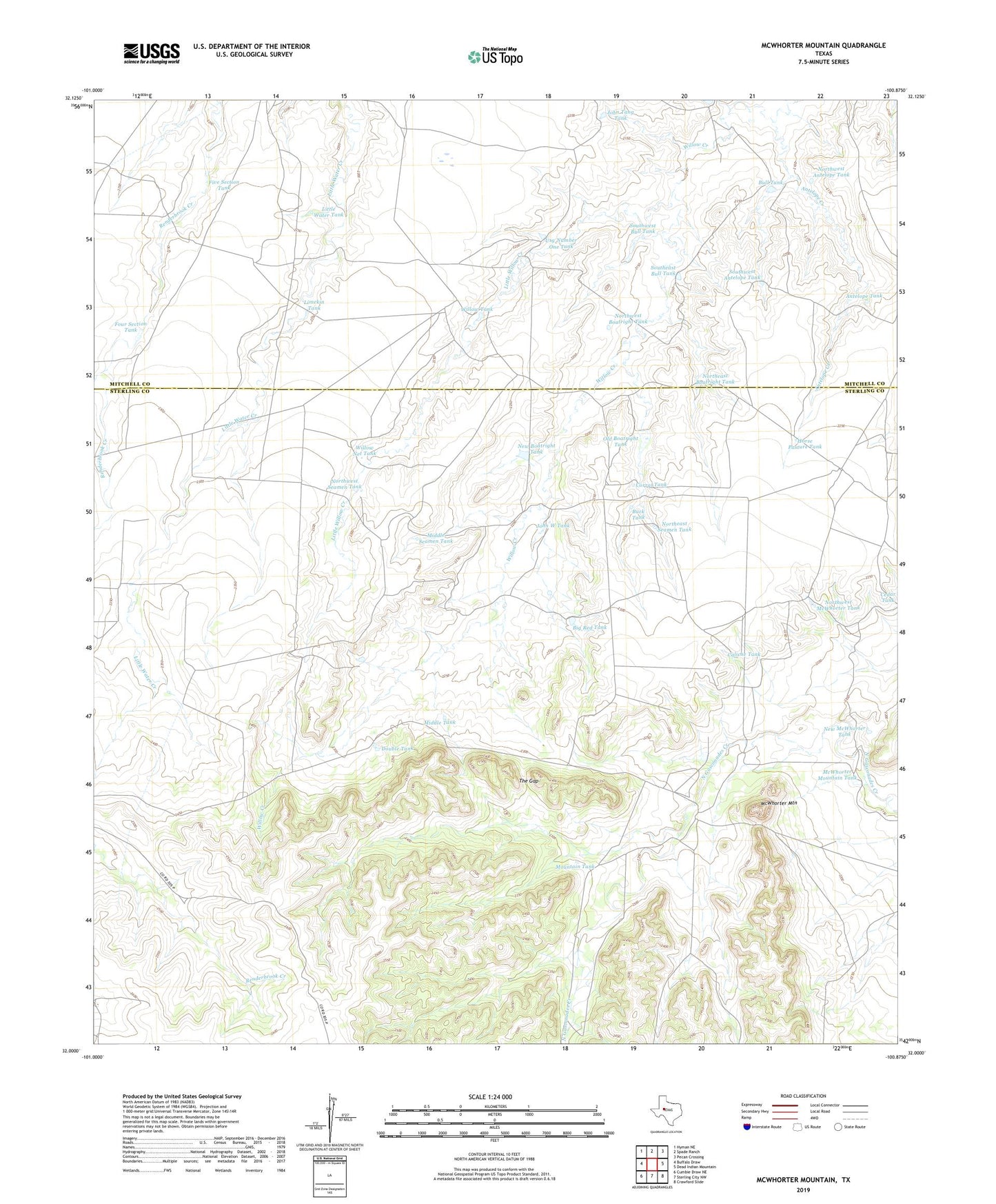
2022 topographic map quadrangle McWhorter Mountain in the state of Texas. Scale: 1:24000. Based on the newly updated USGS 7.5' US Topo map series, this map is in the following counties: Sterling, Mitchell. The map contains contour data, water features, and other items you are used to seeing on USGS maps, but also has updated roads and other features. This is the next generation of topographic maps. Printed on high-quality waterproof paper with UV fade-resistant inks.
Quads adjacent to this one:
West: Buffalo Draw
Northwest: Hyman NE
North: Spade Ranch
Northeast: Pecan Crossing
East: Dead Indian Mountain
Southeast: Crawford Slide
South: Sterling City NW
Southwest: Cumbie Draw NE
This map covers the same area as the classic USGS quad with code o32100a8.
Contains the following named places: Antelope Creek, Antelope Tank, Big Red Tank, Buck Tank, Bull Tank, Caliche Tank, Corral Tank, Dempster Windmill, Divide Windmill, Double Tank, East Windmill, Five Section Tank, Four Section Tank, Horse Pasture Tank, John Tang Tank, John W Tank, Limekin Tank, Little Water Tank, Little Willow Creek, McWhorter Mountain, McWhorter Mountain Tank, Middle Seamen Tank, Middle Tank, Mountain Tank, New Boatright Tank, New McWhorter Tank, Northeast Boatright Tank, Northeast Seamen Tank, Northwest Antelope Tank, Northwest Boatright Tank, Northwest McWhorter Tank, Northwest Seamen Tank, Old Boatright Tank, Powell Sheep Camp, Southeast Bull Tank, Southwest Antelope Tank, Southwest Bull Tank, The Gap, Usg Number One Tank, Willow Net Tank, Willow Tank