MyTopo
Spanish Fort Texas US Topo Map
Couldn't load pickup availability
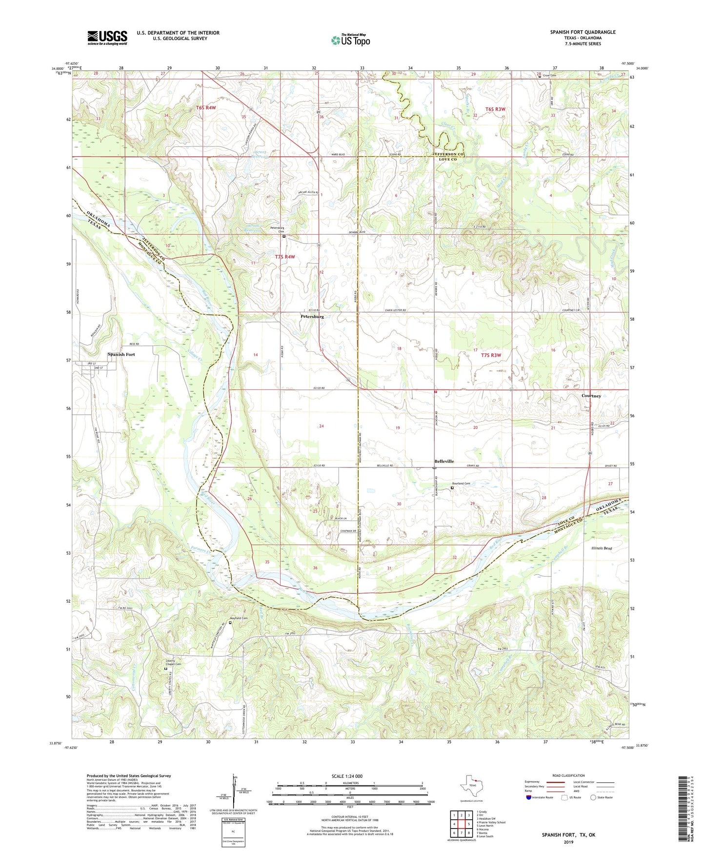
2019 topographic map quadrangle Spanish Fort in the states of Oklahoma, Texas. Scale: 1:24000. Based on the newly updated USGS 7.5' US Topo map series, this map is in the following counties: Montague, Love, Jefferson. The map contains contour data, water features, and other items you are used to seeing on USGS maps, but also has updated roads and other features. This is the next generation of topographic maps. Printed on high-quality waterproof paper with UV fade-resistant inks.
Quads adjacent to this one:
West: Prairie Valley School
Northwest: Grady
North: Orr
Northeast: Healdton SW
East: Leon North
Southeast: Leon South
South: Bonita
Southwest: Nocona
Contains the following named places: Belleville, Boardtree Creek, Bourland Cemetery, Brushy Mound Church, Campbell Branch, Clear Creek, Cottonwood Creek, Courtney, Courtney Post Office, Courtney Volunteer Fire Department, Crow Cemetery, East Sandy Creek, Farmers Creek, Illinois Bend Oil Field, Liberty Chapel Cemetery, Mayfield Cemetery, Oknoname 067015 Dam, Oknoname 067015 Reservoir, Oknoname 067016 Dam, Oknoname 067016 Reservoir, Petersburg, Petersburg Cemetery, Red Branch, Sandy Creek, Spanish Fort, Sparks Branch, Village Creek