MyTopo
Steep Branch Texas US Topo Map
Couldn't load pickup availability
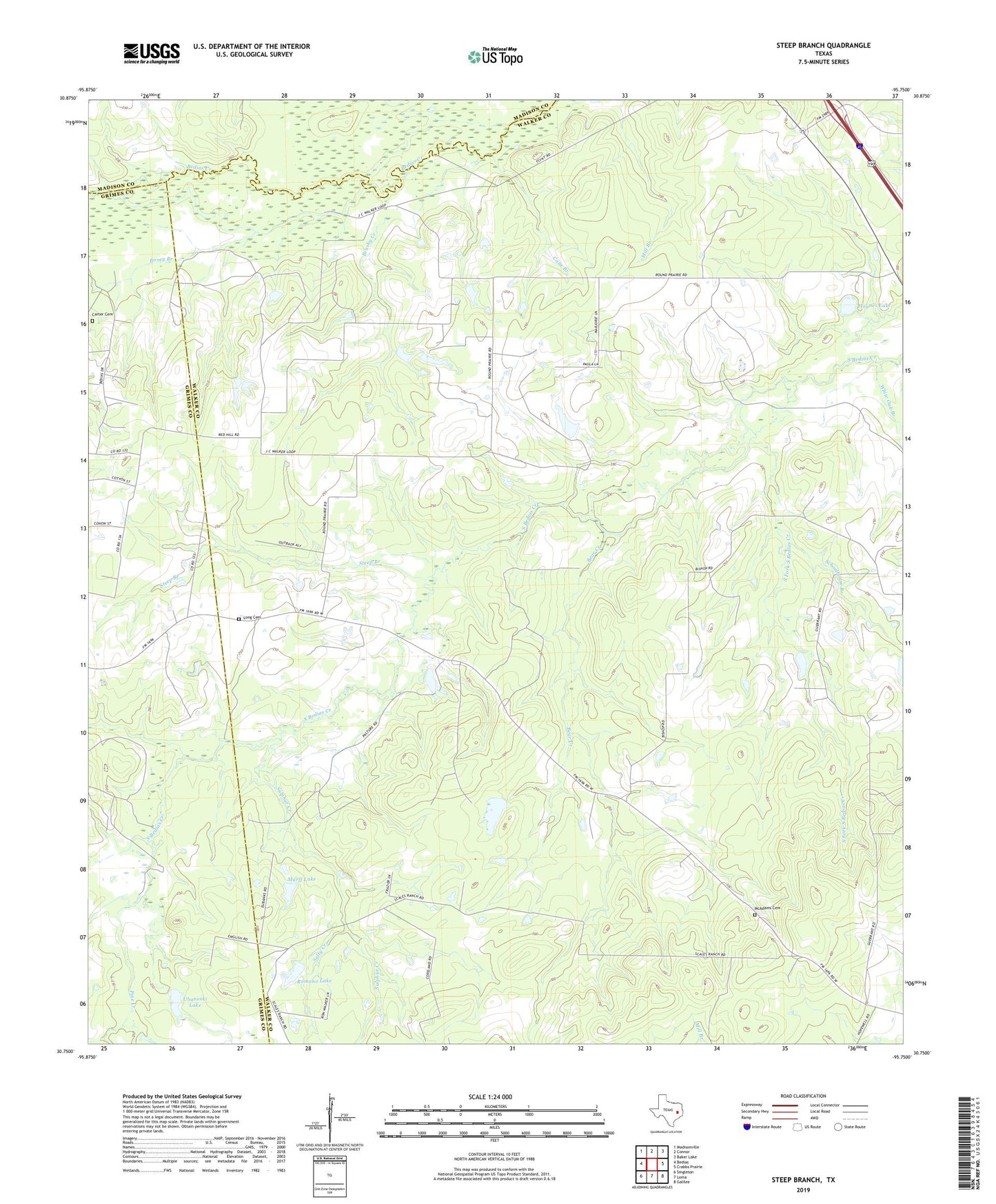
2019 topographic map quadrangle Steep Branch in the state of Texas. Scale: 1:24000. Based on the newly updated USGS 7.5' US Topo map series, this map is in the following counties: Walker, Grimes, Madison. The map contains contour data, water features, and other items you are used to seeing on USGS maps, but also has updated roads and other features. This is the next generation of topographic maps. Printed on high-quality waterproof paper with UV fade-resistant inks.
Quads adjacent to this one:
West: Bedias
Northwest: Madisonville
North: Connor
Northeast: Baker Lake
East: Crabbs Prairie
Southeast: Galilee
South: Loma
Southwest: Singleton
Contains the following named places: Bear Creek, Boney Branch, Brod Lake, Brod Lake Dam, Brushy Creek, Cane Branch, Carter Cemetery, Haynes Lake, Haynes Lake Dam, Jordan Ranch Airport, Long Cemetery, McAdams Cemetery, Mossy Grove, Murff Lake, Murff Lake Dam, Oak Grove School, Paul Church, Pine Creek, Red Hill Church, Romano Lake, Romano Lake Dam, Salty Creek, Sand Branch, Schoolhouse Branch, South Fork South Bedias Creek, Steep Branch, Sulphur Creek, Ubanoski Lake, Ubanoski Lake Dam, White Oak Branch, Woodville Church