MyTopo
Galilee Texas US Topo Map
Couldn't load pickup availability
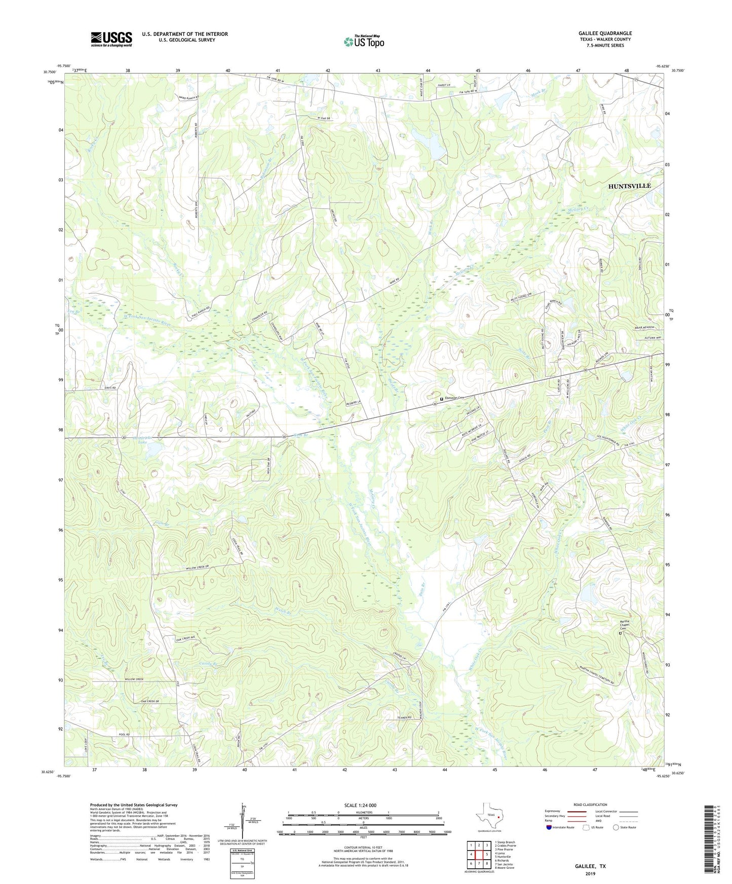
2022 topographic map quadrangle Galilee in the state of Texas. Scale: 1:24000. Based on the newly updated USGS 7.5' US Topo map series, this map is in the following counties: Walker. The map contains contour data, water features, and other items you are used to seeing on USGS maps, but also has updated roads and other features. This is the next generation of topographic maps. Printed on high-quality waterproof paper with UV fade-resistant inks.
Quads adjacent to this one:
West: Loma
Northwest: Steep Branch
North: Crabbs Prairie
Northeast: Pine Prairie
East: Huntsville
Southeast: Moore Grove
South: San Jacinto
Southwest: Richards
This map covers the same area as the classic USGS quad with code o30095f6.
Contains the following named places: Casidy Branch, Central Church, Ebenezer Cemetery, Era Branch, Galilee, Gum Branch, Hendricks Lake, Hendricks Lake Dam, Hills Chapel, Huntsville Division, KCEY-FM (Huntsville), Little Zion Church, Martha Chapel Cemetery, McGary Creek, Medpro Emergency Medical Service, Mock Branch, Mount Zion Church, Mount Zion School, Muecke Dam, Muecke Lake, Pain Branch, Robinson Branch, Rocky Creek, Scott Branch, Walker County Constable's Office Precinct 2, Welch Branch, White Oak Creek