MyTopo
Sterling City Texas US Topo Map
Couldn't load pickup availability
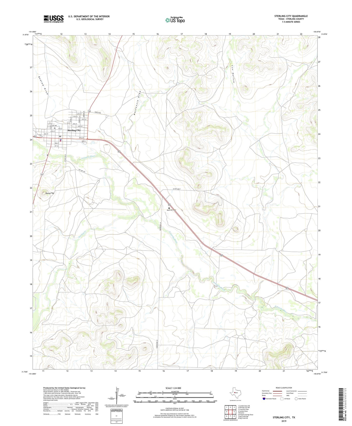
2022 topographic map quadrangle Sterling City in the state of Texas. Scale: 1:24000. Based on the newly updated USGS 7.5' US Topo map series, this map is in the following counties: Sterling. The map contains contour data, water features, and other items you are used to seeing on USGS maps, but also has updated roads and other features. This is the next generation of topographic maps. Printed on high-quality waterproof paper with UV fade-resistant inks.
Quads adjacent to this one:
West: Cumbie Draw
Northwest: Cumbie Draw NE
North: Sterling City NW
Northeast: Crawford Slide
East: Broome
Southeast: Dog Creek NE
South: Dog Creek NW
Southwest: Dripping Springs Draw
This map covers the same area as the classic USGS quad with code o31100g8.
Contains the following named places: Bodcaw Draw, City of Sterling City, Cox Hollow, Mackenzie Draw, Montvale Cemetery, Round Top, Sterling City, Sterling City Cemetery, Sterling City City Hall, Sterling City Elementary and Middle School, Sterling City High School, Sterling City Post Office, Sterling County Emergency Medical Services, Sterling County Fire Department, Sterling County Sheriff's Office, Sterling Creek