MyTopo
Texas Point Texas US Topo Map
Couldn't load pickup availability
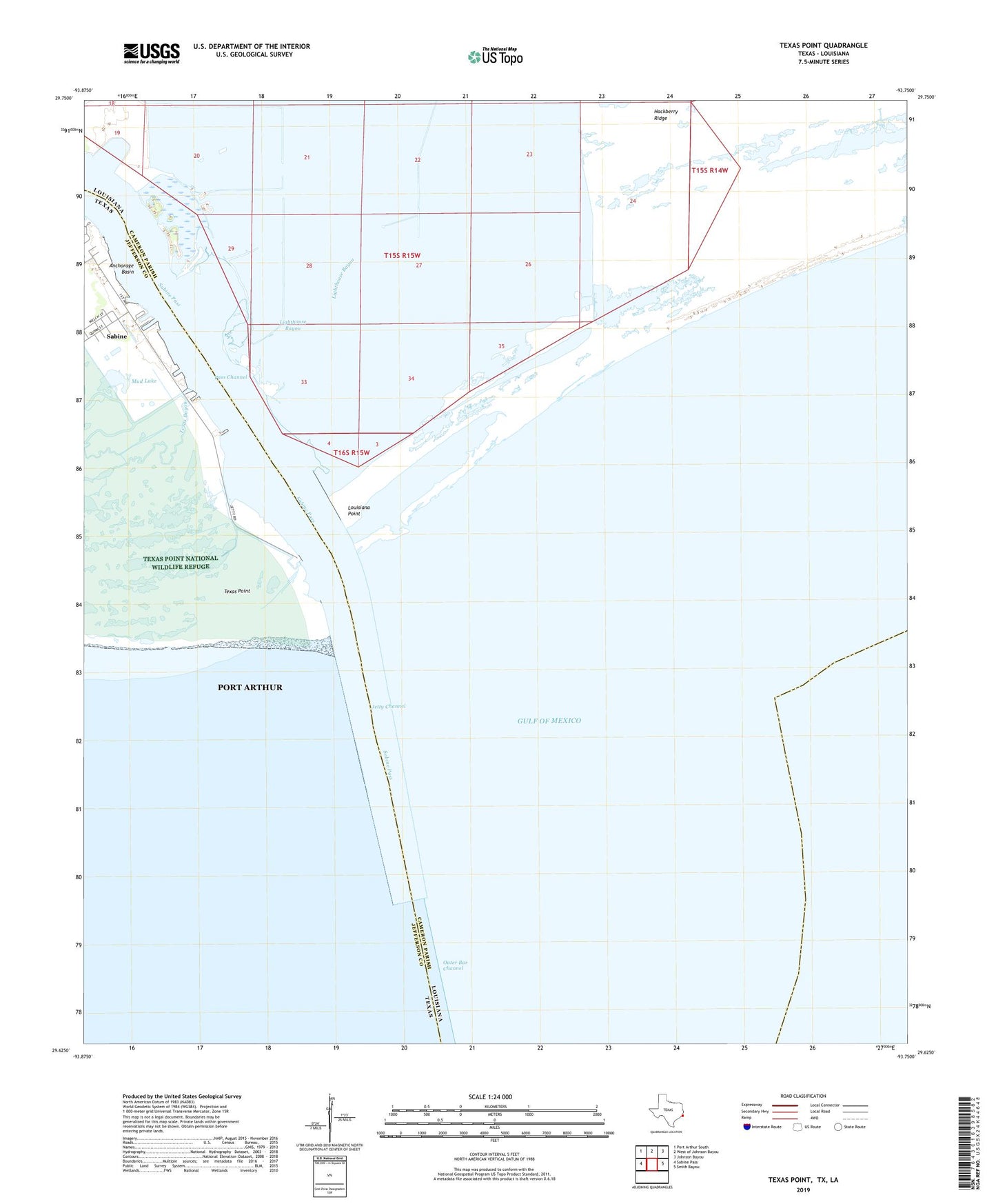
2019 topographic map quadrangle Texas Point in the states of Louisiana, Texas. Scale: 1:24000. Based on the newly updated USGS 7.5' US Topo map series, this map is in the following counties: Jefferson, Cameron. The map contains contour data, water features, and other items you are used to seeing on USGS maps, but also has updated roads and other features. This is the next generation of topographic maps. Printed on high-quality waterproof paper with UV fade-resistant inks.
Quads adjacent to this one:
West: Sabine Pass
Northwest: Port Arthur South
North: West of Johnson Bayou
Northeast: Johnson Bayou
East: Smith Bayou
Contains the following named places: Anchorage Basin, Arco Sabine Heliport, East Jetty, Jetty Channel, Lighthouse Bayou, Louisiana Point, Mud Lake, Outer Bar Channel, Pass Channel, Sabine, Sabine Pass, Sabine Pass Lighthouse, Sabine Pass Lighthouse Reservation, Tenneco Shorebase Heliport, Texas Bayou, Texas Menhaden Strip Airport, Texas Point, West Jetty