MyTopo
Johnson Bayou Louisiana US Topo Map
Couldn't load pickup availability
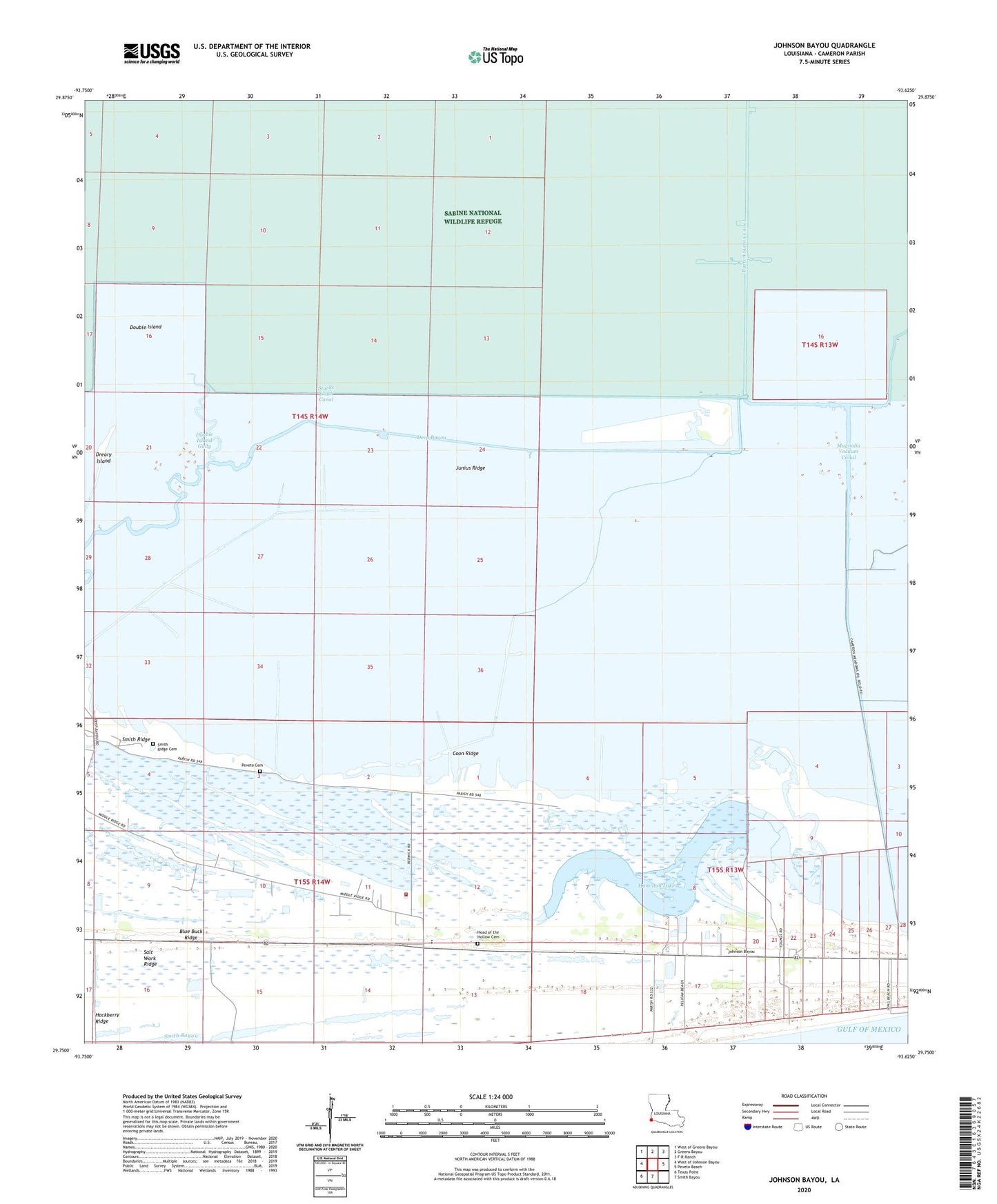
2025 topographic map quadrangle Johnson Bayou in the state of Louisiana. Scale: 1:24000. Based on the newly updated USGS 7.5' US Topo map series, this map is in the following counties: Cameron. The map contains contour data, water features, and other items you are used to seeing on USGS maps, but also has updated roads and other features. This is the next generation of topographic maps. Printed on high-quality waterproof paper with UV fade-resistant inks.
Quads adjacent to this one:
West: West of Johnson Bayou
Northwest: West of Greens Bayou
North: Greens Bayou
Northeast: F-R Ranch
East: Peveto Beach
South: Smith Bayou
Southwest: Texas Point
This map covers the same area as the classic USGS quad with code o29093g6.
Contains the following named places: Blue Buck Ridge, Burton Oil Field, Cameron Meadows Oil and Gas Field, Cameron Parish Police Jury, Cameron Parish Sheriff's Department, Coon Ridge, Deep Bayou, Deep Bayou Oil and Gas Field, Double Island, Double Island Gully, Dreary Island, Hackberry Ridge, Hamilton Lake, Head of the Hollow Cemetery, Hog Gully, Johnson Bayou, Johnson Bayou Baptist Church, Johnson Bayou High School, Johnson Bayou Volunteer Fire Department District 10, Johnsons Bayou, Johnsons Bayou Gas Field, Johnsons Bayou Heliport, Johnsons Bayou Post Office, Junius Ridge, Magnolia Vacuum Canal, Old Bayou, Old North Bayou, Our Lady of Assumption Church, Parish Governing Authority District 1, Peveto Cemetery, Salt Work Ridge, Smith Ridge, Smith Ridge Cemetery, Starks South Canal, Station 44 Heliport