MyTopo
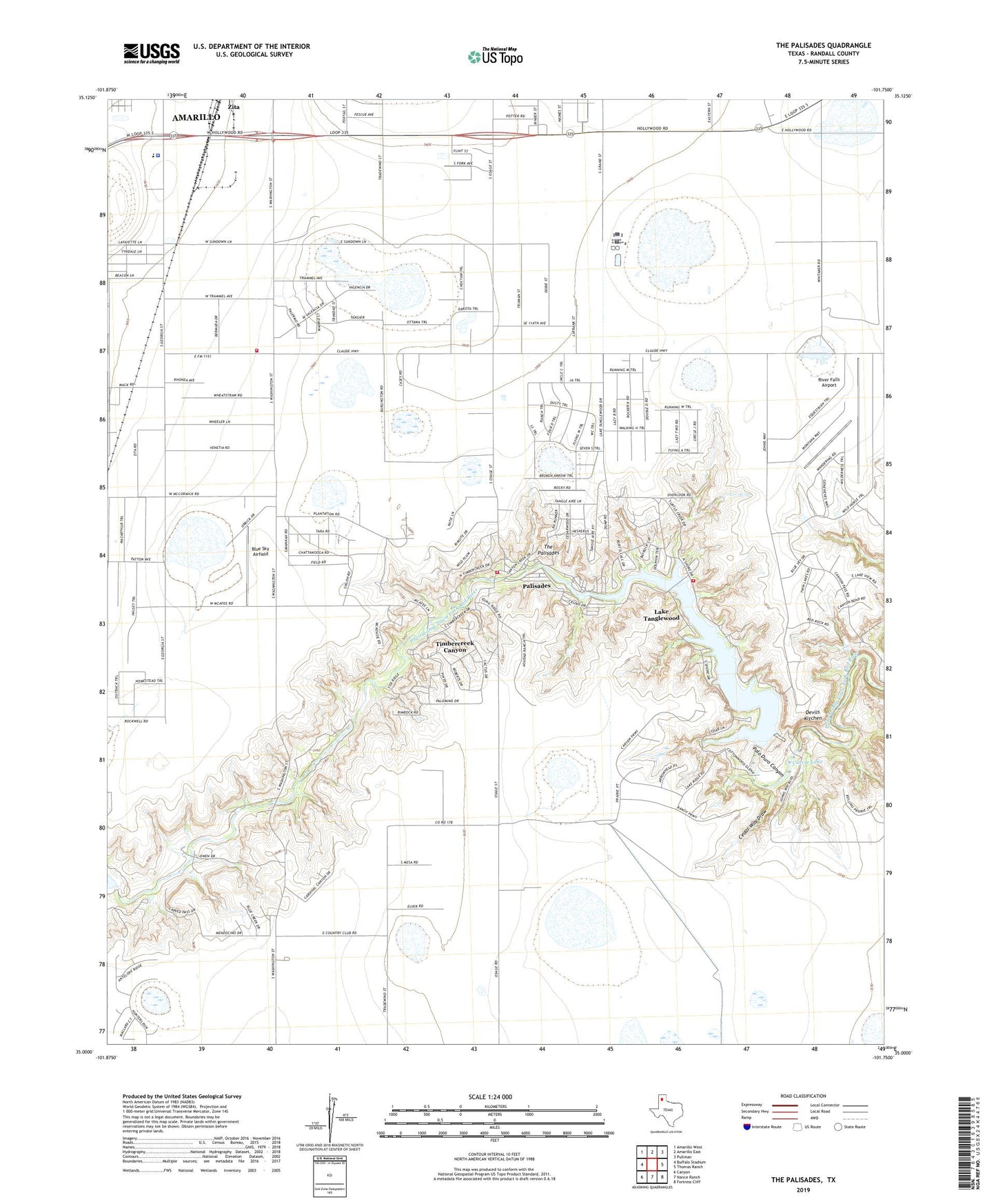
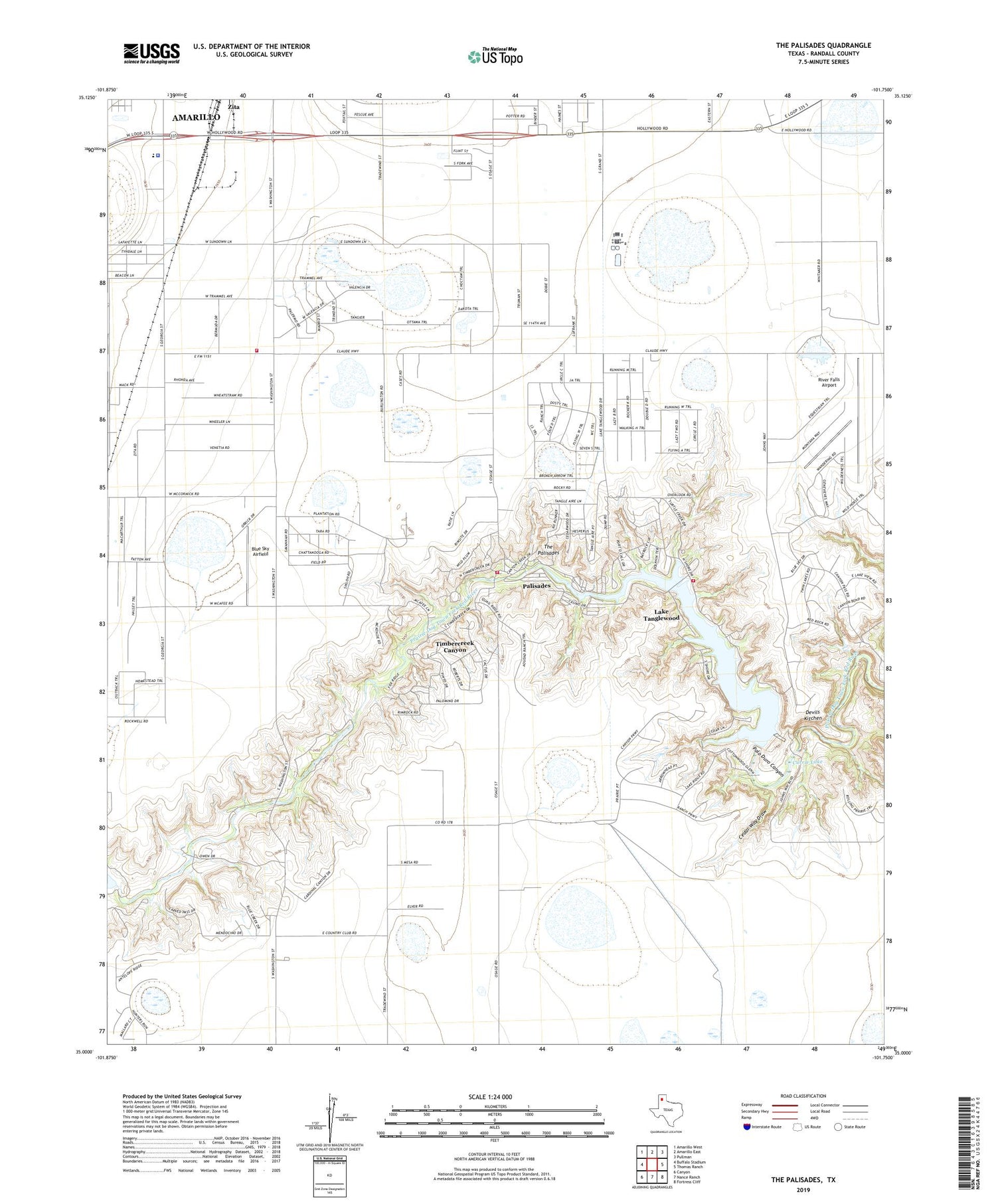
The Palisades Texas US Topo Map
Couldn't load pickup availability
2019 topographic map quadrangle The Palisades in the state of Texas. Scale: 1:24000. Based on the newly updated USGS 7.5' US Topo map series, this map is in the following counties: Randall. The map contains contour data, water features, and other items you are used to seeing on USGS maps, but also has updated roads and other features. This is the next generation of topographic maps. Printed on high-quality waterproof paper with UV fade-resistant inks.
Quads adjacent to this one:
West: Buffalo Stadium
Northwest: Amarillo West
North: Amarillo East
Northeast: Pullman
East: Thomas Ranch
Southeast: Fortress Cliff
South: Nance Ranch
Southwest: Canyon
Contains the following named places: Blue Sky Airfield, Camp Harrington, Cedar Way Draw, Currie Lake, Currie Ranch, Devils Kitchen, Haney, KPUR-AM (Amarillo), Lake Tanglewood, Lake Tanglewood City Hall, Lake Tanglewood Dam, Lake Tanglewood Fire Department and Emergency Medical Service, Palisades, Randall County Correctional Center, Randall County Fire and Rescue Station 1, Randall County Sheriff's Office, River Falls Airport, The Palisades, Timbercreek Canyon, Timbercreek Canyon Volunteer Fire Department, Village of Lake Tanglewood, Village of Palisades, Village of Timbercreek Canyon, Youth Center of High Plains