MyTopo
Thomas Ranch Texas US Topo Map
Couldn't load pickup availability
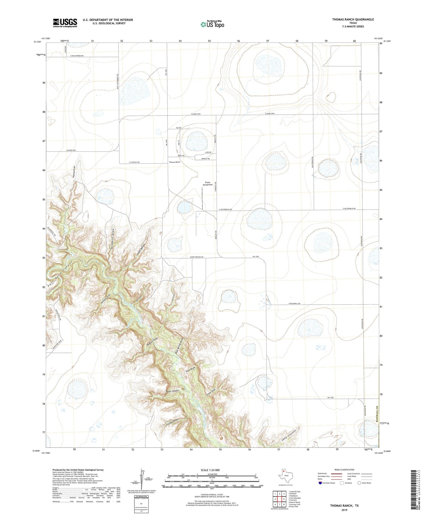
2022 topographic map quadrangle Thomas Ranch in the state of Texas. Scale: 1:24000. Based on the newly updated USGS 7.5' US Topo map series, this map is in the following counties: Randall, Armstrong. The map contains contour data, water features, and other items you are used to seeing on USGS maps, but also has updated roads and other features. This is the next generation of topographic maps. Printed on high-quality waterproof paper with UV fade-resistant inks.
Quads adjacent to this one:
West: The Palisades
Northwest: Amarillo East
North: Pullman
Northeast: Washburn
East: Fairview
Southeast: Pony Flats
South: Fortress Cliff
Southwest: Nance Ranch
This map covers the same area as the classic USGS quad with code o35101a6.
Contains the following named places: Blue Spring Draw, Chalk Hollow, Deep Canyon, Dugout Draw, Evans Aerodrome, Flat Canyon, Forked Draw, Irvin Ranch, Little Draw, Little Falls, Nameless Draw, Owens Ranch, Post Draw, Smoot Ranch, Sorelle Ranch, Spring Branch, Stevens Ranch, Stub Draw, Thomas Draw, Thomas Ranch, Upshaw Ranch, West Fork Prairie Dog Town Fork Red River, Windmill Draw, ZIP Code: 79118