
MyTopo
Thornton Texas US Topo Map
Couldn't load pickup availability
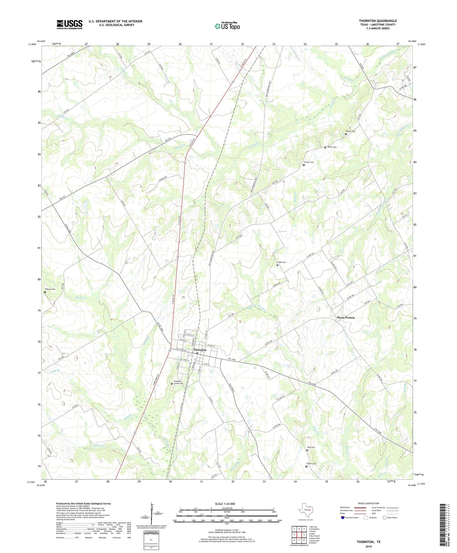
2019 topographic map quadrangle Thornton in the state of Texas. Scale: 1:24000. Based on the newly updated USGS 7.5' US Topo map series, this map is in the following counties: Limestone. The map contains contour data, water features, and other items you are used to seeing on USGS maps, but also has updated roads and other features. This is the next generation of topographic maps. Printed on high-quality waterproof paper with UV fade-resistant inks.
Quads adjacent to this one:
West: Odds
Northwest: Ben Hur
North: Groesbeck
Northeast: Fallon
East: Box Church
Southeast: Oletha
South: Kosse East
Southwest: Kosse West
Contains the following named places: Acuff Branch, Beulah, Carroll Cemetery, Cedar Creek, Cobb Cemetery, Davis Church, Davis Prairie, Eaton Branch, Frost Creek, Keel Creek, King Cemetery, Phifer Cemetery, Phifer Creek, Pippin Cemetery, Pleasant Grove Cemetery, Red Hill, Rocky Creek, Scott Branch, Thornton, Thornton City Office, Thornton Post Office, Tidwell Cemetery, Town of Thornton, Twin Bridges, Vinson Cemetery


