MyTopo
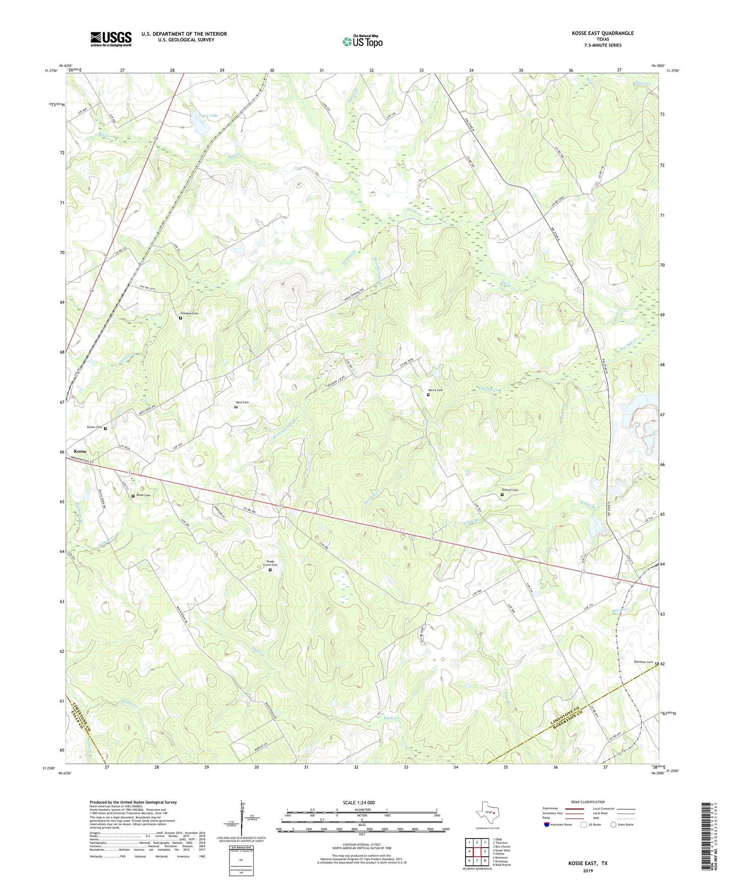
Kosse East Texas US Topo Map
Couldn't load pickup availability
2022 topographic map quadrangle Kosse East in the state of Texas. Scale: 1:24000. Based on the newly updated USGS 7.5' US Topo map series, this map is in the following counties: Limestone, Robertson, Falls. The map contains contour data, water features, and other items you are used to seeing on USGS maps, but also has updated roads and other features. This is the next generation of topographic maps. Printed on high-quality waterproof paper with UV fade-resistant inks.
Quads adjacent to this one:
West: Kosse West
Northwest: Odds
North: Thornton
Northeast: Box Church
East: Oletha
Southeast: Bald Prairie
South: Petteway
Southwest: Bremond
This map covers the same area as the classic USGS quad with code o31096c5.
Contains the following named places: Big Creek, Brier Creek, Burleson Branch, Butler Branch, Buttrill Cemetery, Ebenezer Church, Eutaw Cemetery, Eutaw Church, Gentry Creek, Green Branch, Knox Lake, Knox Lake Dam, Kosse Cemetery, Kosse Division, Mills Creek, Moss Cemetery, Moss Springs Branch, Nance Branch, Norris Cemetery, Shady Grove Cemetery, Shady Grove Church, Sowders Cemetery, ZIP Code: 76653