MyTopo
Box Church Texas US Topo Map
Couldn't load pickup availability
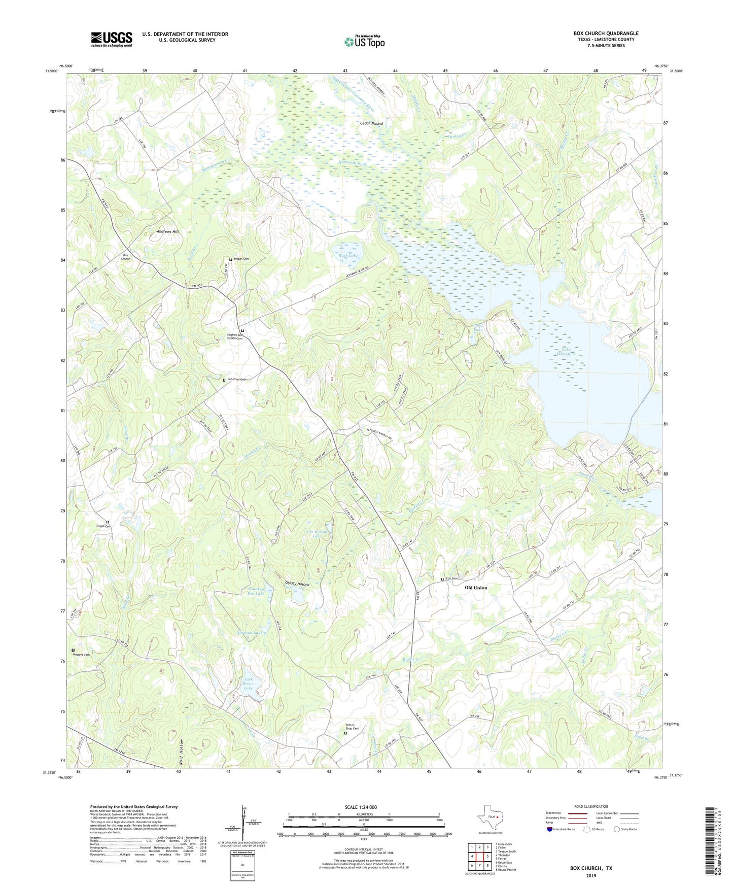
2022 topographic map quadrangle Box Church in the state of Texas. Scale: 1:24000. Based on the newly updated USGS 7.5' US Topo map series, this map is in the following counties: Limestone. The map contains contour data, water features, and other items you are used to seeing on USGS maps, but also has updated roads and other features. This is the next generation of topographic maps. Printed on high-quality waterproof paper with UV fade-resistant inks.
Quads adjacent to this one:
West: Thornton
Northwest: Groesbeck
North: Fallon
Northeast: Teague South
East: Farrar
Southeast: Round Prairie
South: Oletha
Southwest: Kosse East
This map covers the same area as the classic USGS quad with code o31096d4.
Contains the following named places: Andrews Hill, Box Church, Capps Cemetery, Cedar Mound, Clear Lake, Cox Cemetery, Faulkenberry Creek, Grassy Hollow, Hogan Cemetery, Hughes and Hyden Cemetery, Jack Brown Lake, Jim Wright Lake, Lenamon Cemetery, Loftin Creek, Masters Cemetery, Middle Creek, Montgomery Creek, Mullen Lake, Old Channel Navasota River, Old Union, Old Union Church, Potter Shop Cemetery, Rush Lake, Sand Branch, Sand Lake, Simmon Lake, Spring Creek, Thornton Division, Turkey Creek, Water Lake, Younkey Pen Lake