MyTopo
Groesbeck Texas US Topo Map
Couldn't load pickup availability
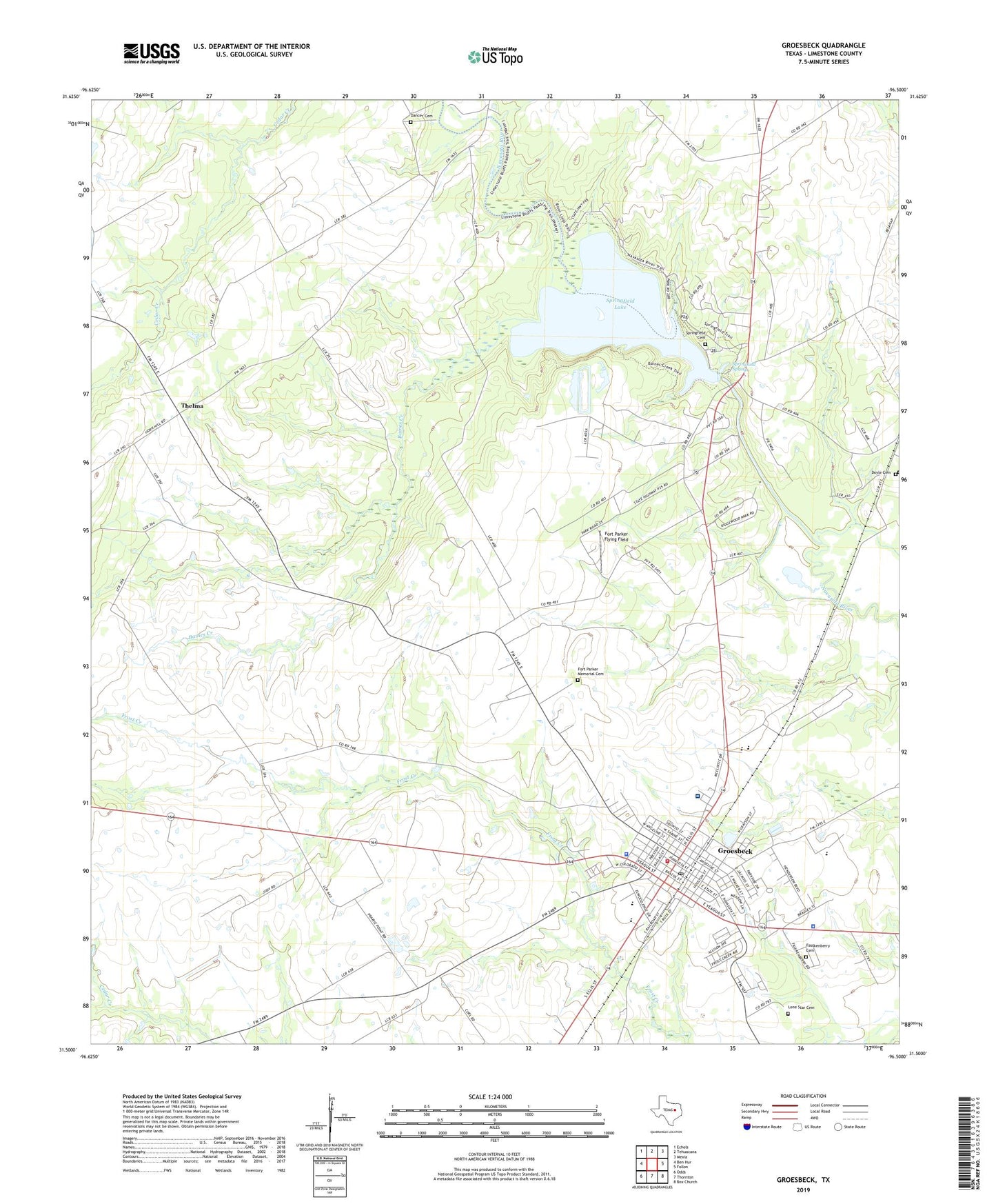
2022 topographic map quadrangle Groesbeck in the state of Texas. Scale: 1:24000. Based on the newly updated USGS 7.5' US Topo map series, this map is in the following counties: Limestone. The map contains contour data, water features, and other items you are used to seeing on USGS maps, but also has updated roads and other features. This is the next generation of topographic maps. Printed on high-quality waterproof paper with UV fade-resistant inks.
Quads adjacent to this one:
West: Ben Hur
Northwest: Echols
North: Tehuacana
Northeast: Mexia
East: Fallon
Southeast: Box Church
South: Thornton
Southwest: Odds
This map covers the same area as the classic USGS quad with code o31096e5.
Contains the following named places: Baines Creek, Bethel Baptist Church, Canaan Chapel, City of Groesbeck, Dancer Cemetery, Dennis Chapel, Doyle, Doyle Cemetery, Enge - Washington Intermediate School, Faulkenberry Cemetery, First Baptist Church, First Church, Fort Parker, Fort Parker Flying Field, Fort Parker Memorial Cemetery, Fort Parker State Park, Fort Parker State Park Hiking Trail, Fort Parker State Park Lake, Fort Parker State Park Lake Dam, Grace Tabernacle Church of God in Christ, Groesbeck, Groesbeck Alternative Learning Center, Groesbeck City Hall, Groesbeck Middle School, Groesbeck Police Department, Groesbeck Post Office, Groesbeck Primary School, Groesbeck Volunteer Fire Department, H O Whitehurst Elementary School, Horn Hill Church, Lake Groesbeck, Lake Groesbeck Dam, Limestone County, Limestone County Constable's Office Precinct 1, Limestone County Constable's Office Precinct 3, Limestone County Courthouse, Limestone County Historical Museum, Limestone County Sheriff's Office, Limestone Detention Center, Limestone Medical Center, Lone Star Baptist Church, Lone Star Cemetery, Mental Health - Mental Retardation Center Heart of Texas, Old Fort Parker State Historical Park, Rock Crossing Church, Round Prairie School, Saint John Church, Springfield Cemetery, Springfield Lake, Springfield Springs, Thelma, Washington High School, ZIP Code: 76642