MyTopo
Three Rivers Texas US Topo Map
Couldn't load pickup availability
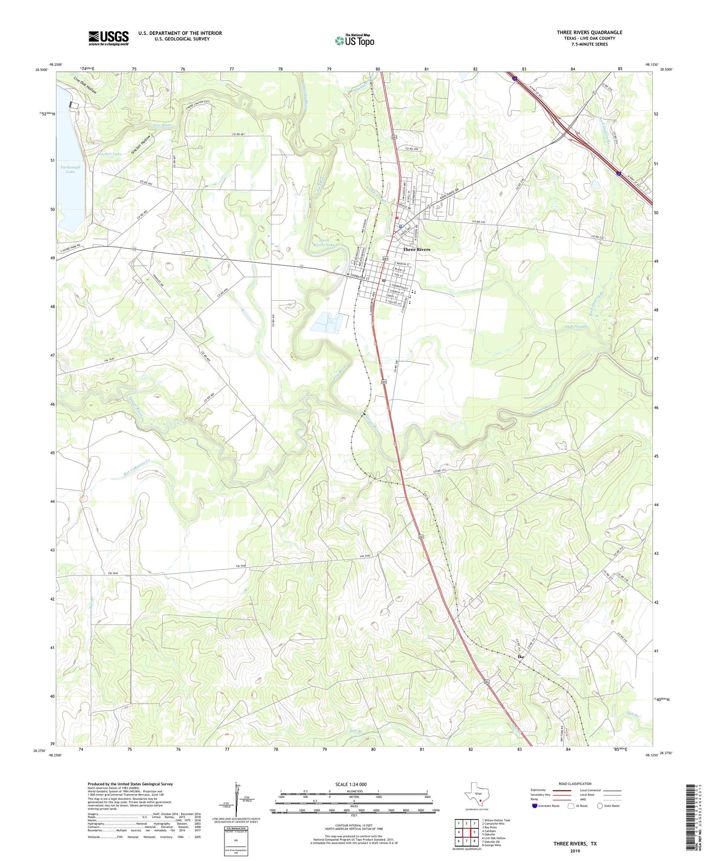
2019 topographic map quadrangle Three Rivers in the state of Texas. Scale: 1:24000. Based on the newly updated USGS 7.5' US Topo map series, this map is in the following counties: Live Oak. The map contains contour data, water features, and other items you are used to seeing on USGS maps, but also has updated roads and other features. This is the next generation of topographic maps. Printed on high-quality waterproof paper with UV fade-resistant inks.
Quads adjacent to this one:
West: Calliham
Northwest: Willow Hollow Tank
North: Comanche Hills
Northeast: Ray Point
East: Oakville
Southeast: George West
South: Oakville SW
Southwest: Live Oak Hollow
Contains the following named places: Atascosa River, Beefmasters Best Airport, Charley York Hollow, Choke Canyon Dam, Choke Canyon State Park - South Shore Unit, City of Three Rivers, Frio River, Hackberry Creek, Ike, Live Oak Hollow, Oakville-Wilcox Gas Field, Olds Slough, Rex Cabaniss Creek, Rock Quarry Branch, Salt Branch, Sinclair Hollow, Sinclair Lake, Three Rivers, Three Rivers Dam, Three Rivers Lake, Three Rivers Police Department, Three Rivers Post Office, Three Rivers Volunteer Fire Department, Tips Park, ZIP Code: 78071