MyTopo
Tovar Creek West Texas US Topo Map
Couldn't load pickup availability
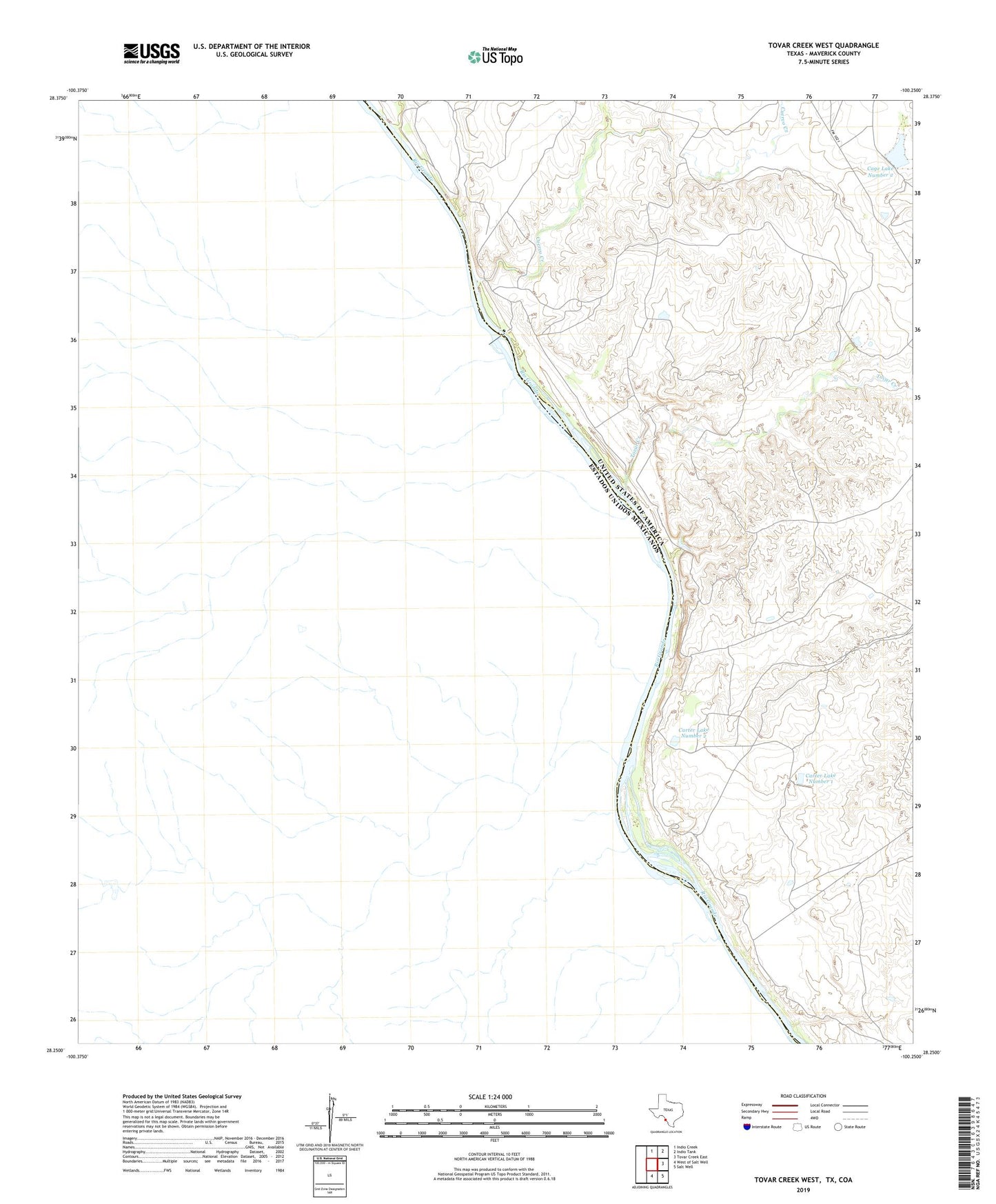
2022 topographic map quadrangle Tovar Creek West in the state of Texas. Scale: 1:24000. Based on the newly updated USGS 7.5' US Topo map series, this map is in the following counties: Maverick. The map contains contour data, water features, and other items you are used to seeing on USGS maps, but also has updated roads and other features. This is the next generation of topographic maps. Printed on high-quality waterproof paper with UV fade-resistant inks.
Quads adjacent to this one:
North: Indio Creek
Northeast: Indio Tank
East: Tovar Creek East
Southeast: Salt Well
South: West of Salt Well
This map covers the same area as the classic USGS quad with code o28100c3.
Contains the following named places: Cage Lake Number 2, Cage Lake Number 2 Dam, Carter Lake Number 1, Carter Lake Number 1 Dam, Carter Lake Number 2, Carter Lake Number 2 Dam, Cuervo Creek, Tovar Creek