MyTopo
Toyah Texas US Topo Map
Couldn't load pickup availability
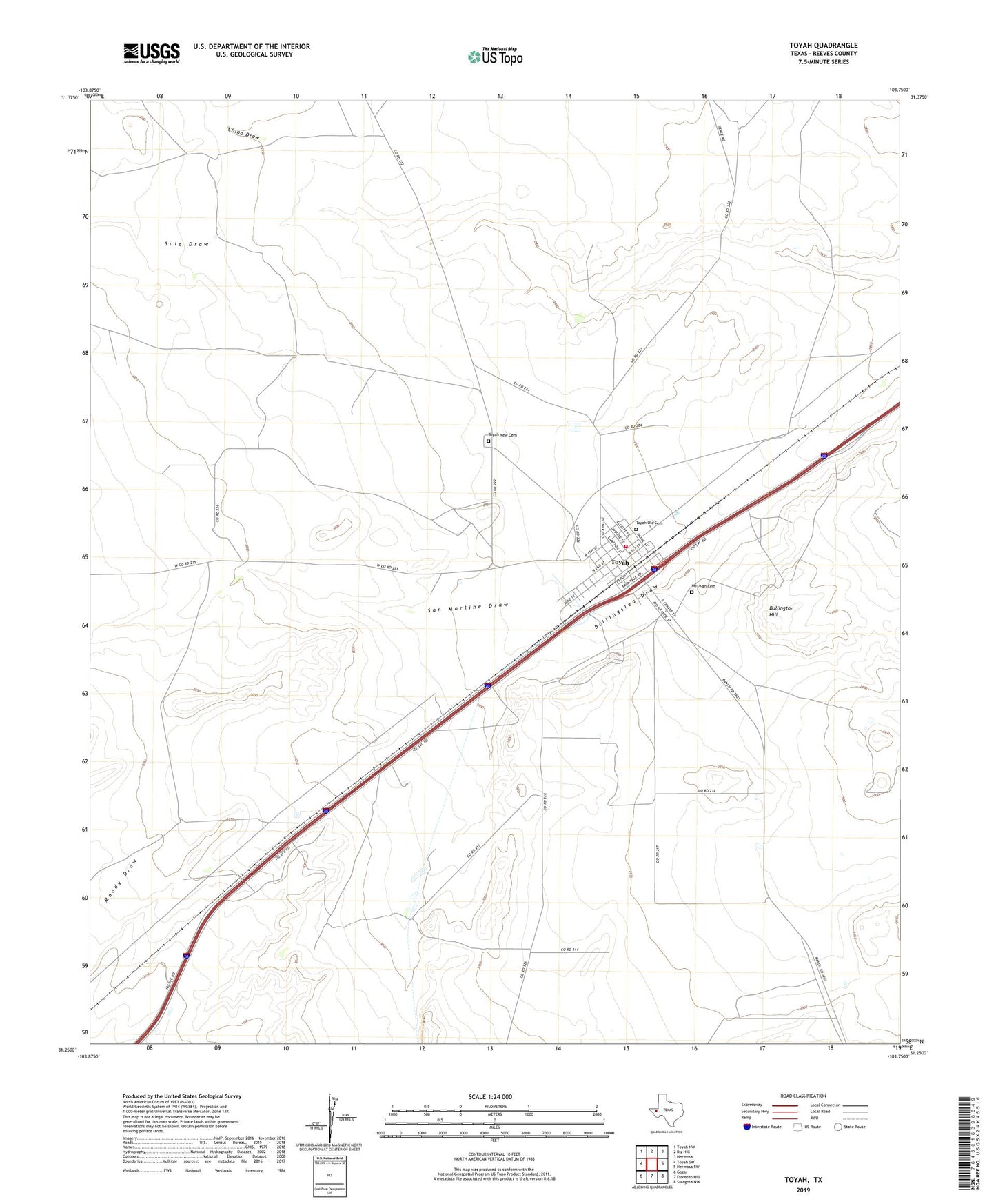
2022 topographic map quadrangle Toyah in the state of Texas. Scale: 1:24000. Based on the newly updated USGS 7.5' US Topo map series, this map is in the following counties: Reeves. The map contains contour data, water features, and other items you are used to seeing on USGS maps, but also has updated roads and other features. This is the next generation of topographic maps. Printed on high-quality waterproof paper with UV fade-resistant inks.
Quads adjacent to this one:
West: Toyah SW
Northwest: Toyah NW
North: Big Hill
Northeast: Hermosa
East: Hermosa SW
Southeast: Saragosa NW
South: Florenzo Hill
Southwest: Gozar
This map covers the same area as the classic USGS quad with code o31103c7.
Contains the following named places: Airport Windmill, Bullington Hill, Cargill Windmill, China Draw, Griffin Windmill, Lee Well, Moody Draw, Pope Windmill, Ray Windmill, Rueben Windmill, San Martine Draw, Town of Toyah, Toyah, Toyah Catholic Cemetery, Toyah New Cemetery, Toyah Old Cemetery, Toyah Post Office, Toyah Volunteer Fire Department, Tucker Well, White House Windmill