MyTopo
Trevat Texas US Topo Map
Couldn't load pickup availability
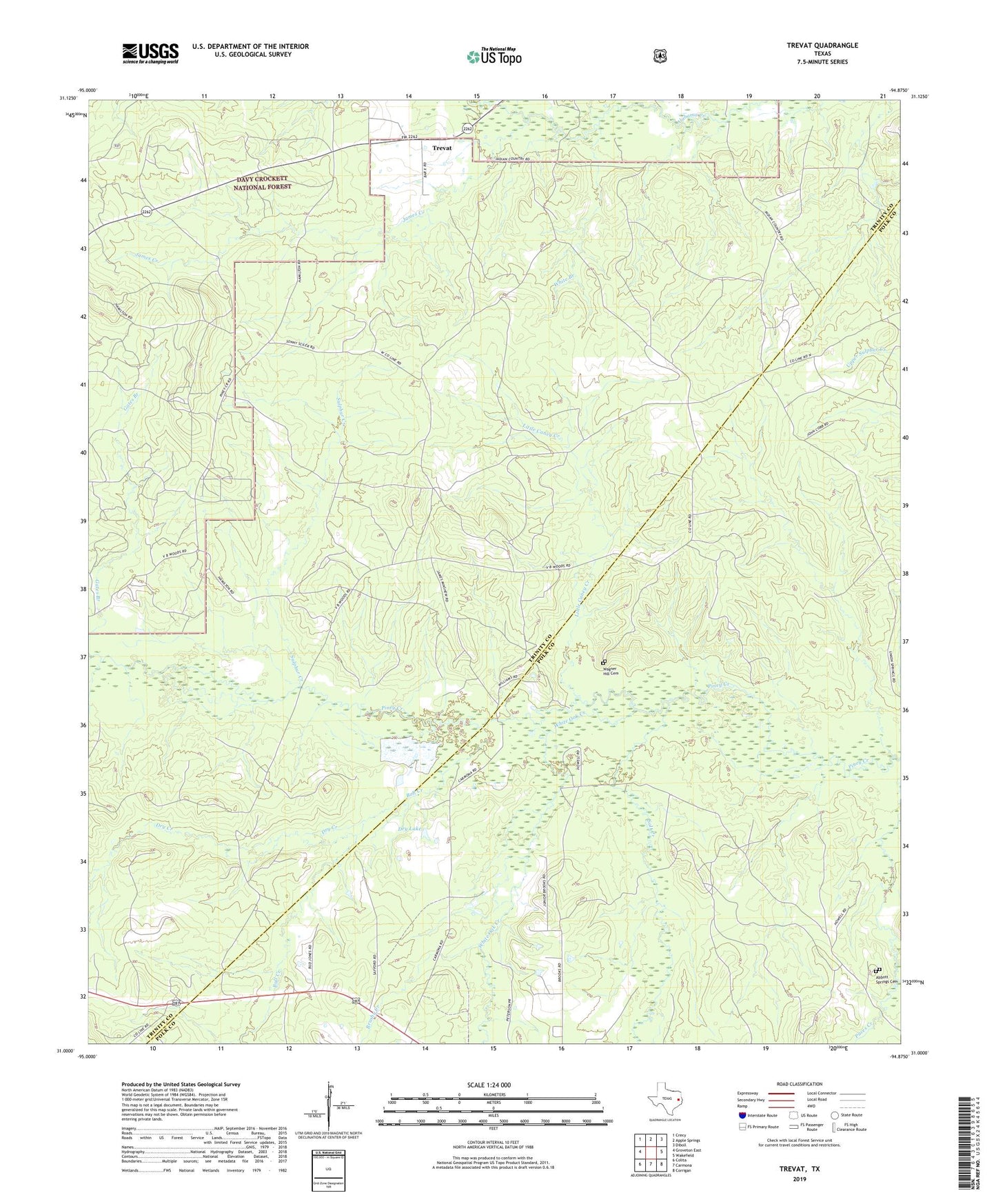
2019 topographic map quadrangle Trevat in the state of Texas. Scale: 1:24000. Based on the newly updated USGS 7.5' US Topo map series, this map is in the following counties: Trinity, Polk. The map contains contour data, water features, and other items you are used to seeing on USGS maps, but also has updated roads and other features. This is the next generation of topographic maps. Printed on high-quality waterproof paper with UV fade-resistant inks.
Quads adjacent to this one:
West: Groveton East
Northwest: Crecy
North: Apple Springs
Northeast: Diboll
East: Wakefield
Southeast: Corrigan
South: Carmona
Southwest: Colita
Contains the following named places: Abbott Springs Cemetery, Adams Spring Branch, Brushy Creek, Bull Creek, Dry Creek, Dry Lake, James Creek, Little Caney Creek, North Creek, Salt Creek, Sulphur, Sulphur Creek, Sulphur Springs Church, Trevat, Wagner Hill Cemetery, White Branch, White Oak Creek