MyTopo
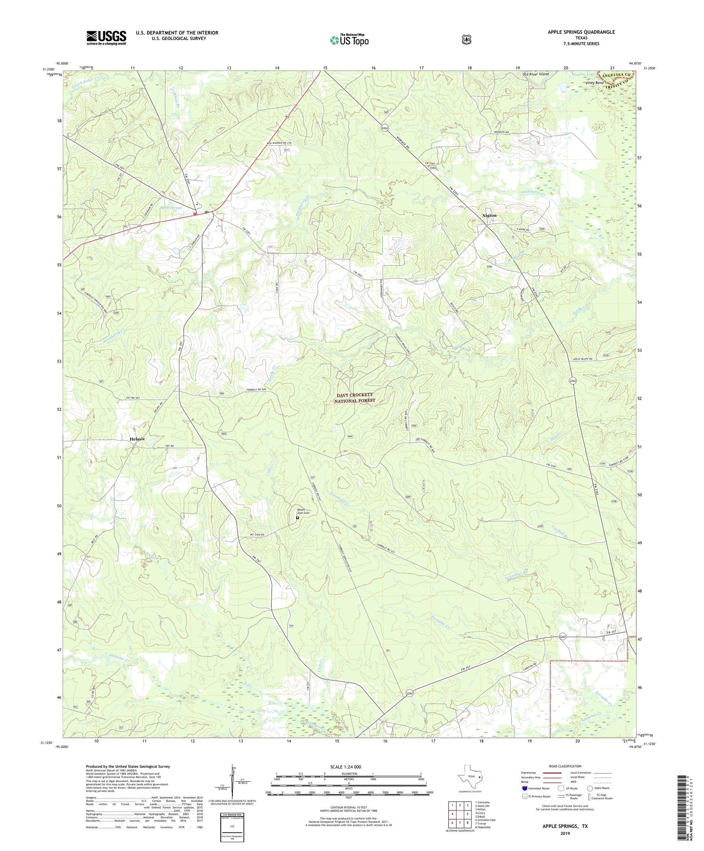
Apple Springs Texas US Topo Map
Couldn't load pickup availability
Also explore the Apple Springs Forest Service Topo of this same quad for updated USFS data
2022 topographic map quadrangle Apple Springs in the state of Texas. Scale: 1:24000. Based on the newly updated USGS 7.5' US Topo map series, this map is in the following counties: Trinity, Angelina. The map contains contour data, water features, and other items you are used to seeing on USGS maps, but also has updated roads and other features. This is the next generation of topographic maps. Printed on high-quality waterproof paper with UV fade-resistant inks.
Quads adjacent to this one:
West: Crecy
Northwest: Centralia
North: Wells SW
Northeast: Keltys
East: Diboll
Southeast: Wakefield
South: Trevat
Southwest: Groveton East
This map covers the same area as the classic USGS quad with code o31094b8.
Contains the following named places: Alabama Creek WMA, Apple Springs, Apple Springs Division, Apple Springs Forest Service Facility, Apple Springs Post Office, Apple Springs Volunteer Fire Department, Black Lake Creek, Crib Creek, Faglea Lake, Forsythe Creek, Helmic, Lancaster Creek, Mayo Church, Mount Zion Cemetery, Mount Zion Lookout, Nigton, Old River Island, Viney Bend, West Mark Branch, ZIP Code: 75926