MyTopo
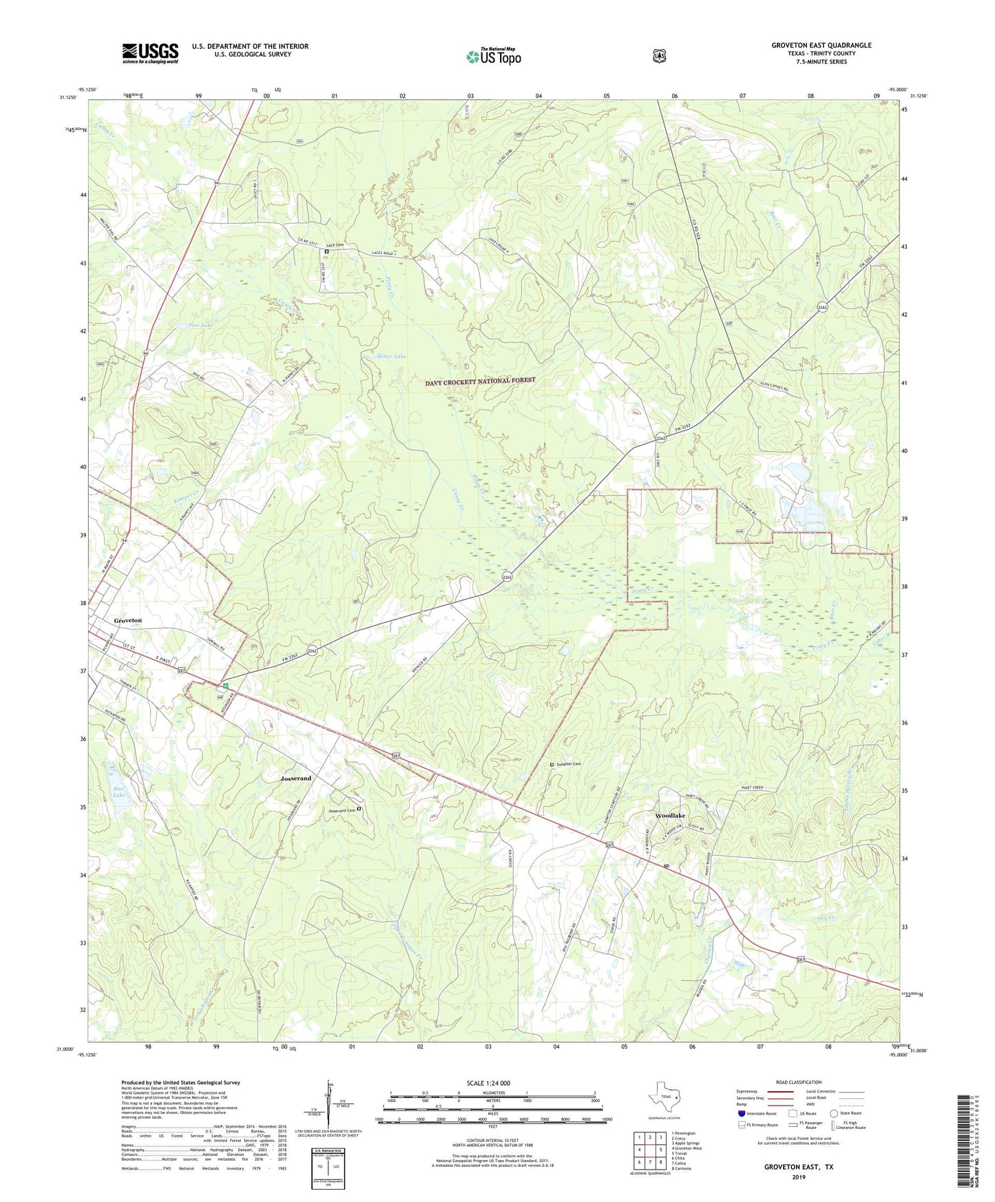
Groveton East Texas US Topo Map
Couldn't load pickup availability
Also explore the Groveton East Forest Service Topo of this same quad for updated USFS data
2022 topographic map quadrangle Groveton East in the state of Texas. Scale: 1:24000. Based on the newly updated USGS 7.5' US Topo map series, this map is in the following counties: Trinity. The map contains contour data, water features, and other items you are used to seeing on USGS maps, but also has updated roads and other features. This is the next generation of topographic maps. Printed on high-quality waterproof paper with UV fade-resistant inks.
Quads adjacent to this one:
West: Groveton West
Northwest: Pennington
North: Crecy
Northeast: Apple Springs
East: Trevat
Southeast: Carmona
South: Colita
Southwest: Chita
This map covers the same area as the classic USGS quad with code o31095a1.
Contains the following named places: Bear Creek, Caney Creek, Gates Branch, Hawthorne Church, Josserand, Josserand Cemetery, Kemper Creek, Kickapoo Campground, Lacy, Lacy Cemetery, Mount Olive Church, New Hope Church, Oaklawn Church, Pine Lake, Piney Woods Camp, Piney Woods Lookout Tower, Price Lake, Price Lake Dam, Rice Lake, Rice Lake Dam, Ritter Lake, Saint Paul Church, Sumpter, Sumpter Cemetery, Woodlake, Woodlake Post Office, ZIP Code: 75845