MyTopo
Turkey Creek Texas US Topo Map
Couldn't load pickup availability
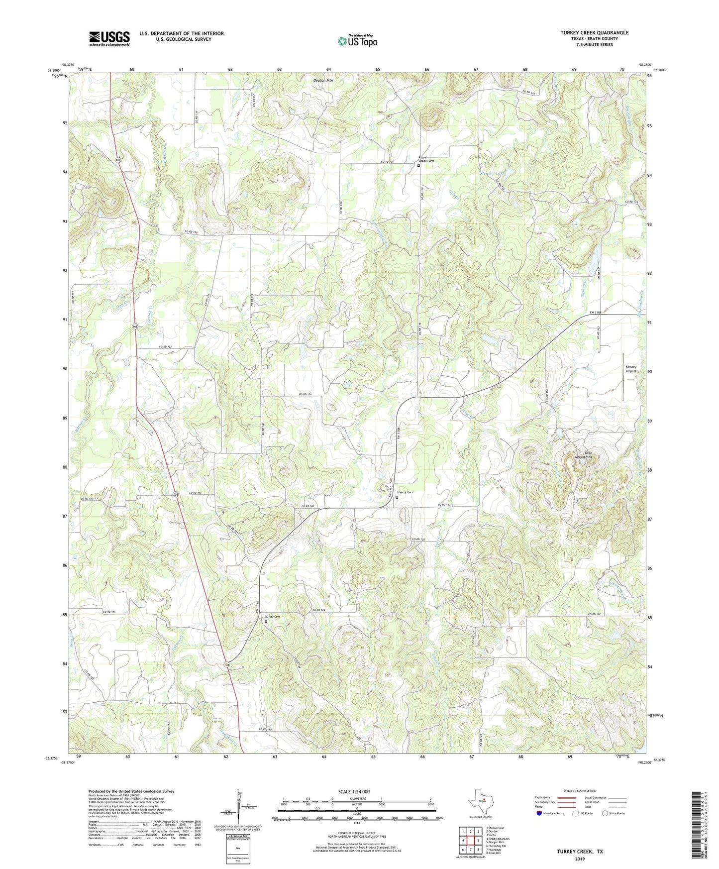
2019 topographic map quadrangle Turkey Creek in the state of Texas. Scale: 1:24000. Based on the newly updated USGS 7.5' US Topo map series, this map is in the following counties: Erath. The map contains contour data, water features, and other items you are used to seeing on USGS maps, but also has updated roads and other features. This is the next generation of topographic maps. Printed on high-quality waterproof paper with UV fade-resistant inks.
Quads adjacent to this one:
West: Reddy Mountain
Northwest: Strawn East
North: Gordon
Northeast: Santo
East: Morgan Mill
Southeast: Knob Hill
South: Huckabay
Southwest: Huckabay SW
Contains the following named places: Clapp Lake, Clapp Lake Dam, Dearing Ranch Airport, Deaton Mountain, Hannibal Creek, Kimzey Airport, Liberty Cemetery, Russel Chapel Cemetery, Salt Creek, Sims Creek, Stewart Lake, Stewart Lake Dam, Turkey Creek, Twin Mountains, X-Ray Cemetery, X-Ray Gas Field