MyTopo
Strawn East Texas US Topo Map
Couldn't load pickup availability
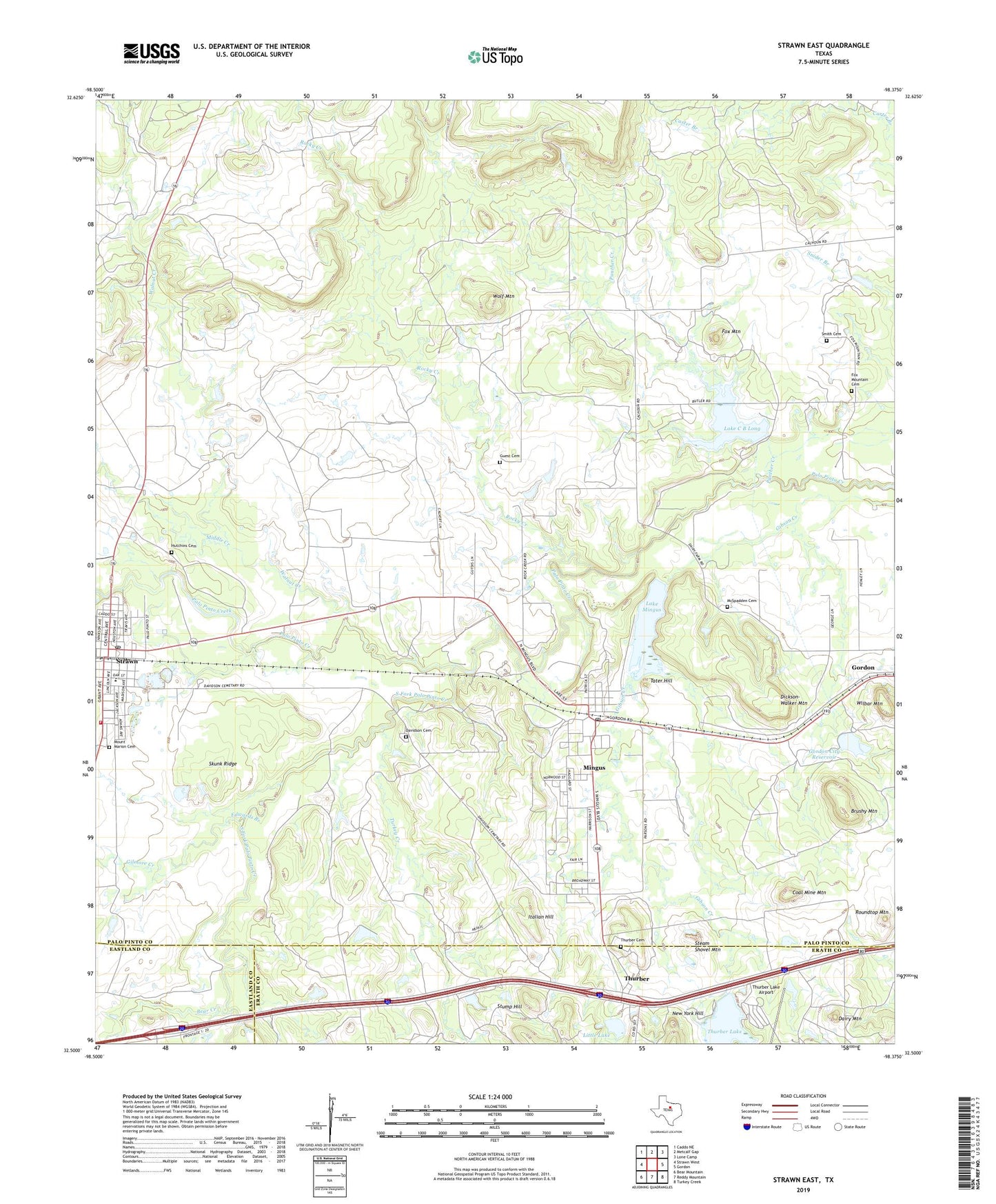
2022 topographic map quadrangle Strawn East in the state of Texas. Scale: 1:24000. Based on the newly updated USGS 7.5' US Topo map series, this map is in the following counties: Palo Pinto, Erath, Eastland. The map contains contour data, water features, and other items you are used to seeing on USGS maps, but also has updated roads and other features. This is the next generation of topographic maps. Printed on high-quality waterproof paper with UV fade-resistant inks.
Quads adjacent to this one:
West: Strawn West
Northwest: Caddo NE
North: Metcalf Gap
Northeast: Lone Camp
East: Gordon
Southeast: Turkey Creek
South: Reddy Mountain
Southwest: Bear Mountain
This map covers the same area as the classic USGS quad with code o32098e4.
Contains the following named places: Bear Creek, Boles Rector Oil Field, Brushy Mountain, City of Mingus, City of Strawn, Coal Mine Mountain, Dairy Mountain, Davidson Cemetery, Dickson-Walker Mountain, Edwards Branch, Fox Mountain, Fox Mountain Cemetery, Gilmore Creek, Gordon City Reservoir, Gordon City Reservoir Dam, Gordon Lake, Guest Cemetery, Hutchins Cemetery, Italian Hill, Lake C B Long, Lake C B Long Dam, Lake Mingus, Little Lake, Lyra, McSpadden Cemetery, Middle Creek, Mingus, Mingus City Hall, Mingus Lake Dam, Mingus Post Office, Mount Marion Cemetery, New York Hill, Panther Creek, Rocky Creek, Roundtop Mountain, Skunk Ridge, Smith Cemetery, South Fork Palo Pinto Creek, Steam Shovel Mountain, Strawn, Strawn City Hall, Strawn Post Office, Strawn Volunteer Fire Department, Stump Hill, Tater Hill, Thurber, Thurber Cemetery, Thurber Historic District, Thurber Lake, Thurber Lake Airport, Thurber Lake Dam, Thurber Lake Number 2, Thurber Lake Number 2 Dam, Thurber Lake Number 3, Thurber Lake Number 3 Dam, Turkey Creek, Walnut Creek, Wilbar Mountain, Wolf Mountain