MyTopo
Gordon Texas US Topo Map
Couldn't load pickup availability
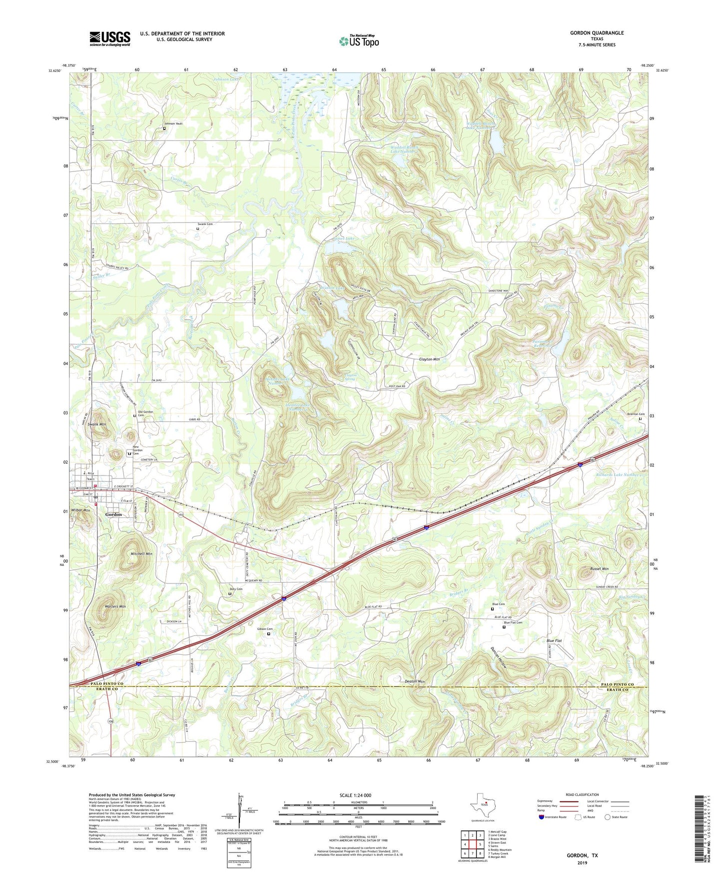
2022 topographic map quadrangle Gordon in the state of Texas. Scale: 1:24000. Based on the newly updated USGS 7.5' US Topo map series, this map is in the following counties: Palo Pinto, Erath. The map contains contour data, water features, and other items you are used to seeing on USGS maps, but also has updated roads and other features. This is the next generation of topographic maps. Printed on high-quality waterproof paper with UV fade-resistant inks.
Quads adjacent to this one:
West: Strawn East
Northwest: Metcalf Gap
North: Lone Camp
Northeast: Brazos West
East: Santo
Southeast: Morgan Mill
South: Turkey Creek
Southwest: Reddy Mountain
This map covers the same area as the classic USGS quad with code o32098e3.
Contains the following named places: Barton Creek, Blue Cemetery, Blue Flat, Blue Flat Cemetery, Bridges Branch, Brierton Cemetery, Carter Branch, City of Gordon, Clayton Mountain, Clayton Spring, Coalville, Doty Cemetery, Duncan Hollow, Gibson Cemetery, Gibson Creek, Gordon, Gordon City Hall, Gordon Junction, Gordon Post Office, Gordon Volunteer Fire Department, Gordon Volunteer Fire Department Station 2, Henslee Lake Number 1, Henslee Lake Number 1 Dam, Henslee Lake Number 2, Henslee Lake Number 2 Dam, James Lake, James Lake Dam, Johnson Vault, Judd Switch, Little Sunday Creek, Longhorn Stadium, Lost Creek, Mitchell Mountain, Mount Zion Church, New Gordon Cemetery, Old Gordon Cemetery, Panama Creek, Panama Creek Reservoir, Panama Creek Reservoir Dam, Richards Lake Number 1, Richards Lake Number 1 Dam, Russel Mountain, Saline Creek, Snider Branch, Swank Cemetery, Swank Mountain, Tri City Emergency Medical Services, Waddell Ranch Dam Number 3, Waddell Ranch Lake Number 1, Waddell Ranch Lake Number 1 Dam, Waddell Ranch Lake Number 3, Warters Mountain, Watson Lake, Watson Lake Dam, ZIP Code: 76453