MyTopo
Santo Texas US Topo Map
Couldn't load pickup availability
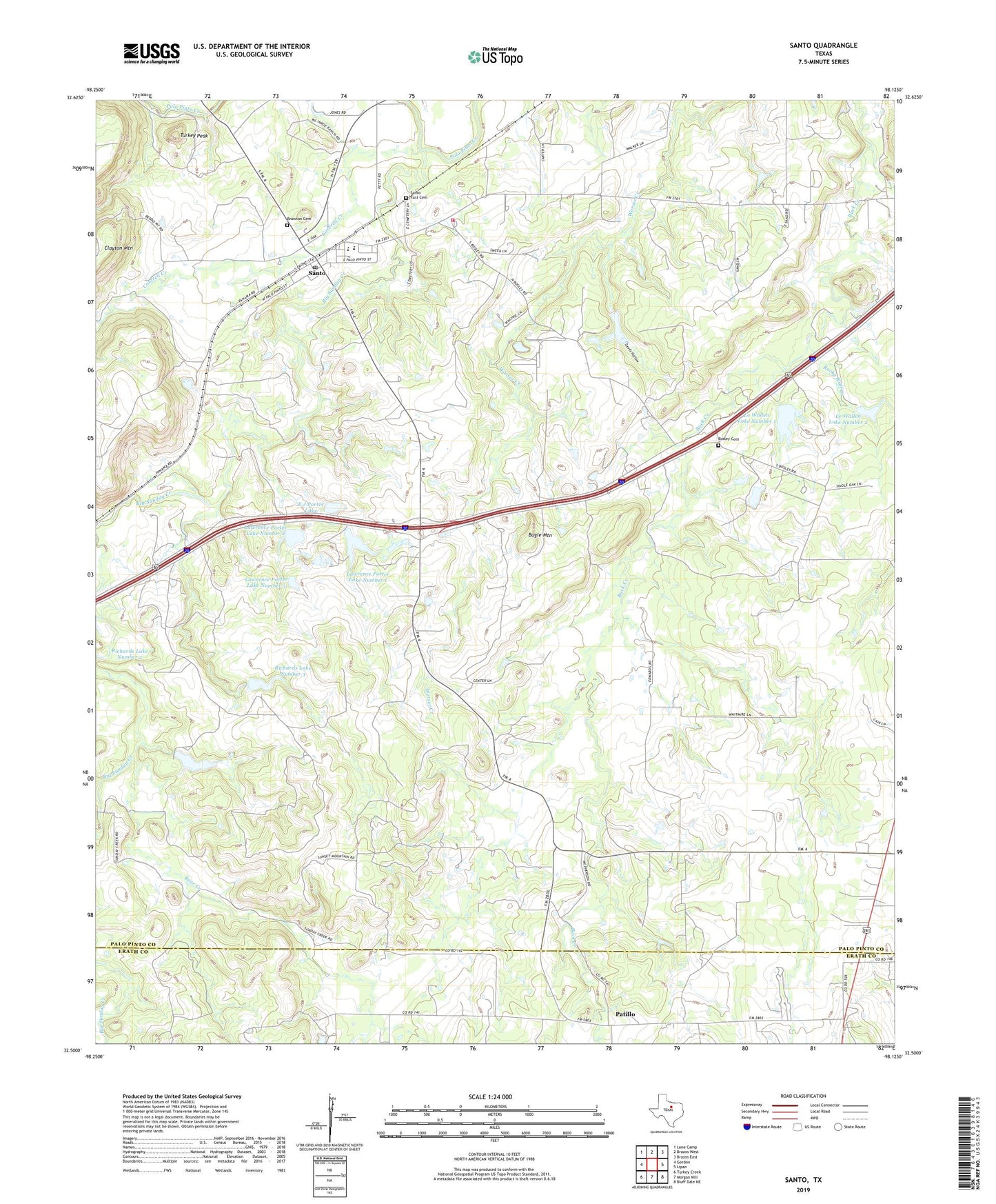
2022 topographic map quadrangle Santo in the state of Texas. Scale: 1:24000. Based on the newly updated USGS 7.5' US Topo map series, this map is in the following counties: Palo Pinto, Erath. The map contains contour data, water features, and other items you are used to seeing on USGS maps, but also has updated roads and other features. This is the next generation of topographic maps. Printed on high-quality waterproof paper with UV fade-resistant inks.
Quads adjacent to this one:
West: Gordon
Northwest: Lone Camp
North: Brazos West
Northeast: Brazos East
East: Lipan
Southeast: Bluff Dale NE
South: Morgan Mill
Southwest: Turkey Creek
This map covers the same area as the classic USGS quad with code o32098e2.
Contains the following named places: Bear Creek, Big Sunday Creek, Bosley Cemetery, Brannon Cemetery, Bugle Mountain, Cantrell Creek, Devils Hollow, E J Porter Lake, E J Porter Lake Dam, Lawrence Porter Lake Number 1, Lawrence Porter Lake Number 1 Dam, Lawrence Porter Lake Number 2, Lawrence Porter Lake Number 2 Dam, Lawrence Porter Lake Number 3, Lawrence Porter Lake Number 3 Dam, Le Wallen Lake Number 1, Le Wallen Lake Number 1 Dam, Le Wallen Lake Number 2, Le Wallen Lake Number 2 Dam, Palo Pinto County Constable's Office Precinct 1, Patillo, Richards Lake Number 2, Richards Lake Number 2 Dam, Richards Lake Number 3, Richards Lake Number 3 Dam, Richards Lake Number 4, Richards Lake Number 4 Dam, Rocky Bluff Creek, Santo, Santo Census Designated Place, Santo East Cemetery, Santo Post Office, Santo Volunteer Fire - EMS Department, Turkey Peak, ZIP Code: 76472