MyTopo
Turkey Texas US Topo Map
Couldn't load pickup availability
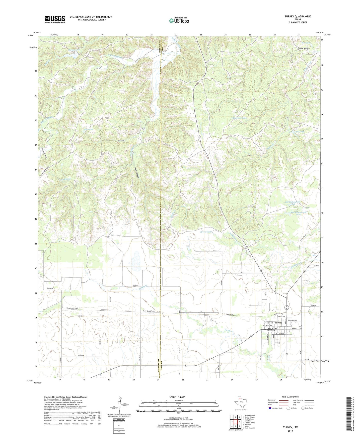
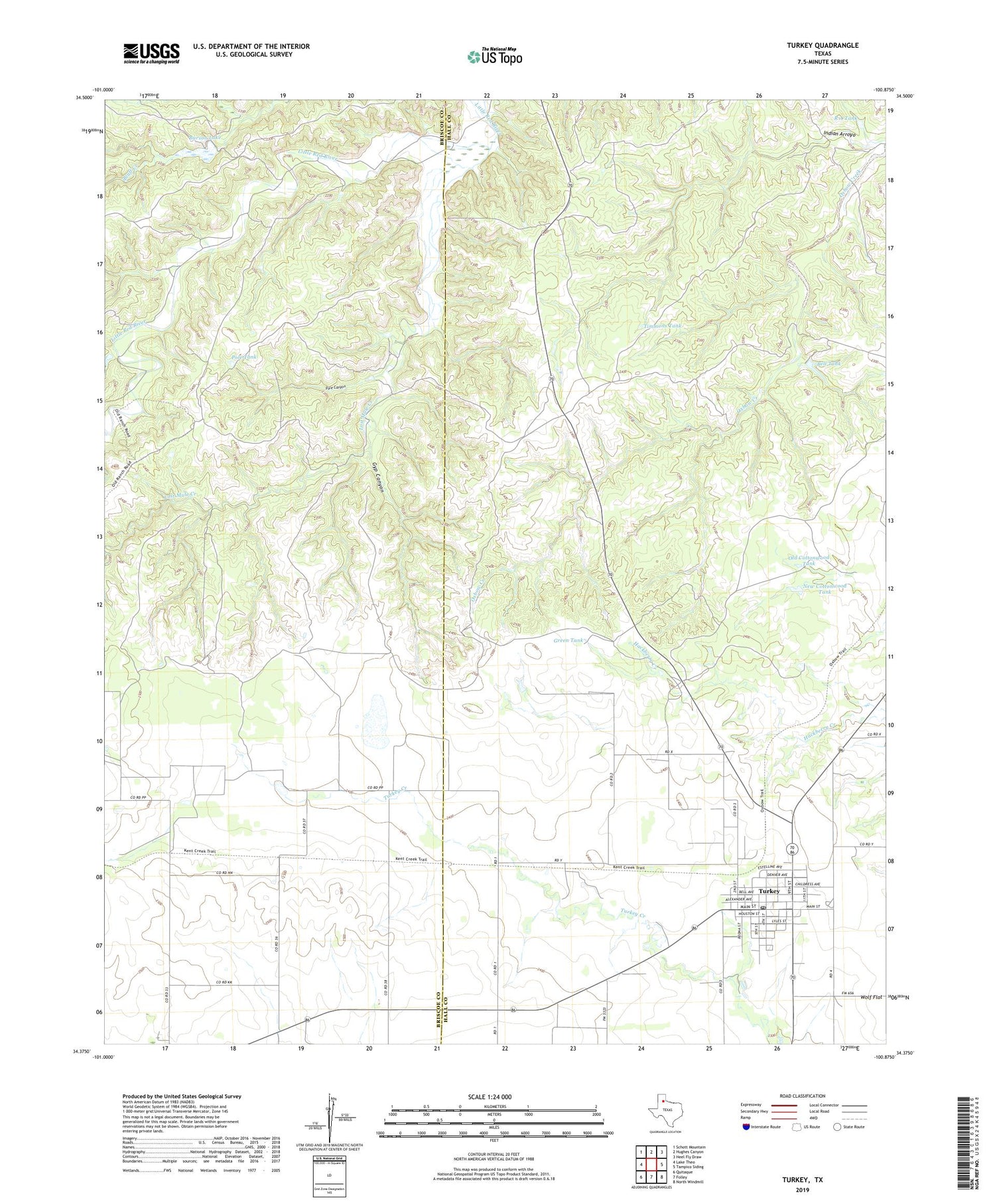
2019 topographic map quadrangle Turkey in the state of Texas. Scale: 1:24000. Based on the newly updated USGS 7.5' US Topo map series, this map is in the following counties: Hall, Briscoe. The map contains contour data, water features, and other items you are used to seeing on USGS maps, but also has updated roads and other features. This is the next generation of topographic maps. Printed on high-quality waterproof paper with UV fade-resistant inks.
Quads adjacent to this one:
West: Lake Theo
Northwest: Schott Mountain
North: Hughes Canyon
Northeast: Heel Fly Draw
East: Tampico Siding
Southeast: North Windmill
South: Folley
Southwest: Quitaque
Contains the following named places: Bell Tank, Big Mule Creek Windmill, Burson Lake, Burson Lake Dam, City of Turkey, Forks Windmill, Fuston Camp Windmill, Green Tank, Gyp Canyon, Hotel Turkey, Little Mule Creek Windmill, Lost Mule Creek, Lower Windmill, Middle Windmill, New Cottonwood Tank, Old Cottonwood Tank, Pole Canyon, Pole Tank, R A Tank, Timmons Tank, Turkey, Turkey Ambulance Service, Turkey City Hall, Turkey Post Office