MyTopo
Quitaque Texas US Topo Map
Couldn't load pickup availability
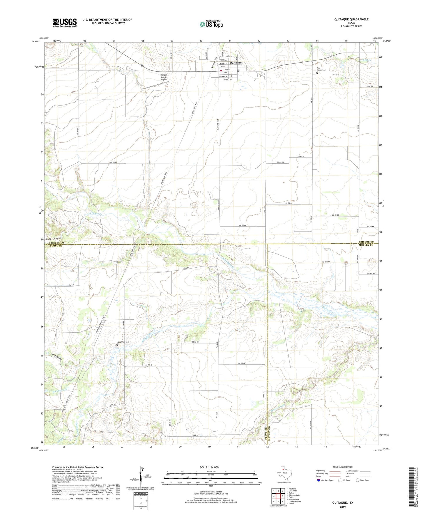
2022 topographic map quadrangle Quitaque in the state of Texas. Scale: 1:24000. Based on the newly updated USGS 7.5' US Topo map series, this map is in the following counties: Briscoe, Floyd, Motley. The map contains contour data, water features, and other items you are used to seeing on USGS maps, but also has updated roads and other features. This is the next generation of topographic maps. Printed on high-quality waterproof paper with UV fade-resistant inks.
Quads adjacent to this one:
West: Edgemon Lake
Northwest: Hay Lake
North: Lake Theo
Northeast: Turkey
East: Folley
Southeast: Flomot
South: Quitaque Peaks
Southwest: Wilson Creek
This map covers the same area as the classic USGS quad with code o34101c1.
Contains the following named places: City of Quitaque, Cottonwood Creek, Fairmont, Gasoline, Gray Mule, Gray Mule Cemetery, Hackberry Creek, Henson Farms Airport, Long Hollow, Los Lingos Creek, Pole Canyon, Puckett Dam, Puckett Lake, Quitague City Hall, Quitaque, Quitaque Ambulance Service, Quitaque Post Office, Quitaque Volunteer Fire Department, Rest Haven Cemetery, ZIP Code: 79255