MyTopo
Twin Mountains Texas US Topo Map
Couldn't load pickup availability
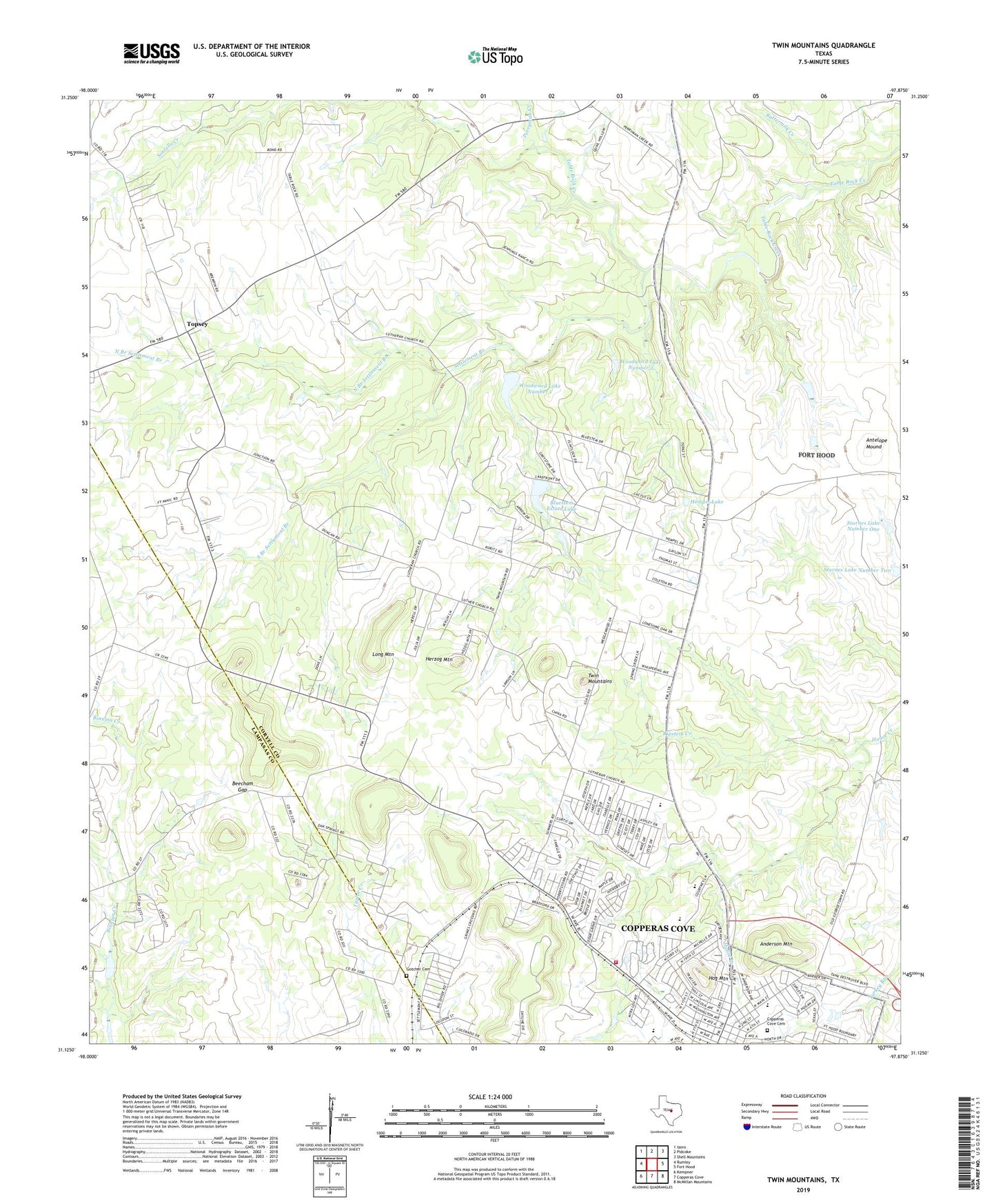
2019 topographic map quadrangle Twin Mountains in the state of Texas. Scale: 1:24000. Based on the newly updated USGS 7.5' US Topo map series, this map is in the following counties: Coryell, Lampasas. The map contains contour data, water features, and other items you are used to seeing on USGS maps, but also has updated roads and other features. This is the next generation of topographic maps. Printed on high-quality waterproof paper with UV fade-resistant inks.
Quads adjacent to this one:
West: Rumley
Northwest: Izoro
North: Pidcoke
Northeast: Shell Mountains
East: Fort Hood
Southeast: McMillan Mountains
South: Copperas Cove
Southwest: Kempner
Contains the following named places: Anderson Mountain, Antelope Mound, Beecham Gap, Bluestem Estate Lake, Bluestem Estates Lake Dam, Buttermilk Creek, Copperas Cove Cemetery, Copperas Cove City Park, Copperas Cove Division, Copperas Cove Fire Department Station 2, Copperas Cove High School, Copperas Cove Municipal Golf Course, Faith Baptist Church, Gotcher Cemetery, Halstead Elementary School, Halstead School, Hempel Dam, Hempel Lake, Herzog Mountain, Hog Mountain, Immanuel Church, J L Williams - Lovett Ledger Elementary School, Joy Christian Community Church, KOOV-FM (Copperas Cove), Loett Ledger Intermediate School, Long Mountain, Lovett Ledger Intermediate School, North Branch Settlement Branch, Perryman Creek, Ripstein Creek, Settlement Branch, South Branch Settlement Branch, Southern Hills Baptist Church, Starnes Lake Number One, Starnes Lake Number Two, Topsey, Twin Mountains, Unity Missionary Baptist Church, Woodward Dam Number 1, Woodward Dam Number 2, Woodward Lake Number 1, Woodward Lake Number 2, ZIP Code: 76522