MyTopo
Kempner Texas US Topo Map
Couldn't load pickup availability
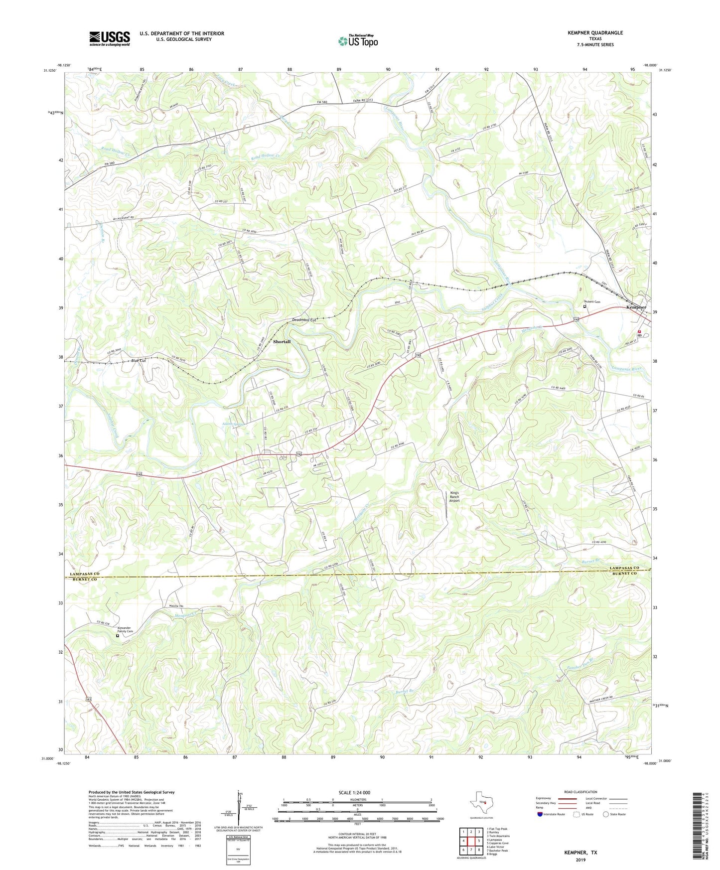
2022 topographic map quadrangle Kempner in the state of Texas. Scale: 1:24000. Based on the newly updated USGS 7.5' US Topo map series, this map is in the following counties: Lampasas, Burnet. The map contains contour data, water features, and other items you are used to seeing on USGS maps, but also has updated roads and other features. This is the next generation of topographic maps. Printed on high-quality waterproof paper with UV fade-resistant inks.
Quads adjacent to this one:
West: Lampasas
Northwest: Flat Top Peak
North: Rumley
Northeast: Twin Mountains
East: Copperas Cove
Southeast: Briggs
South: Bachelor Peak
Southwest: Lake Victor
This map covers the same area as the classic USGS quad with code o31098a1.
Contains the following named places: Adams Spring, Alexander Family Cemetery, Blue Cut, Brooks Crossing, Deadmans Cut, Denson Branch, Hallmark Crossing, Kempner, Kempner City Hall, Kempner Post Office, Kempner Volunteer Fire Department, King's Ranch Airport, Lampasas Pumping Station, Lucy Creek, Mesquite Creek, Pickett Cemetery, Road Hollow Creek, Shortall, Sulphur Creek, ZIP Code: 76539