MyTopo
Valley View Texas US Topo Map
Couldn't load pickup availability
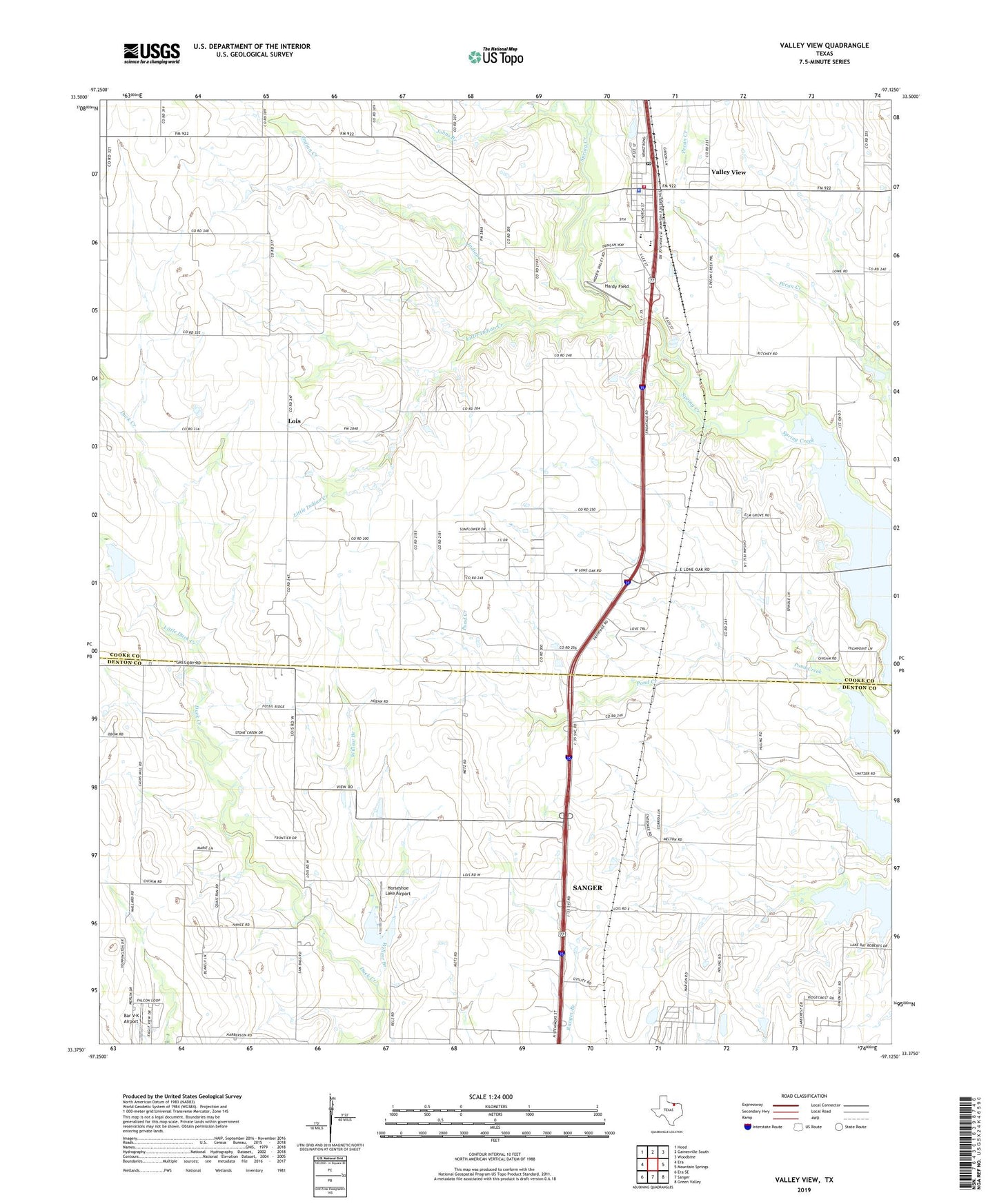
2019 topographic map quadrangle Valley View in the state of Texas. Scale: 1:24000. Based on the newly updated USGS 7.5' US Topo map series, this map is in the following counties: Cooke, Denton. The map contains contour data, water features, and other items you are used to seeing on USGS maps, but also has updated roads and other features. This is the next generation of topographic maps. Printed on high-quality waterproof paper with UV fade-resistant inks.
Quads adjacent to this one:
West: Era
Northwest: Hood
North: Gainesville South
Northeast: Woodbine
East: Mountain Springs
Southeast: Green Valley
South: Sanger
Southwest: Era SE
Contains the following named places: Bar V K Airport, City of Valley View, Cooke County Constable's Office Precinct 4, Cornerstone Baptist Church, First Baptist Church, Hardy Field, Horseshoe Lake Airport, Indian Creek, Johns Branch, Little Duck Creek, Little Indian Creek, Lois, Soil Conservation Service Site 52 Dam, Soil Conservation Service Site 52 Reservoir, Soil Conservation Service Site 53 Dam, Soil Conservation Service Site 53 Reservoir, Union Hill, Valley View, Valley View City Hall, Valley View Police Department, Valley View Post Office, Valley View Volunteer Fire Department, Willow Branch, ZIP Code: 76272