MyTopo
Era SE Texas US Topo Map
Couldn't load pickup availability
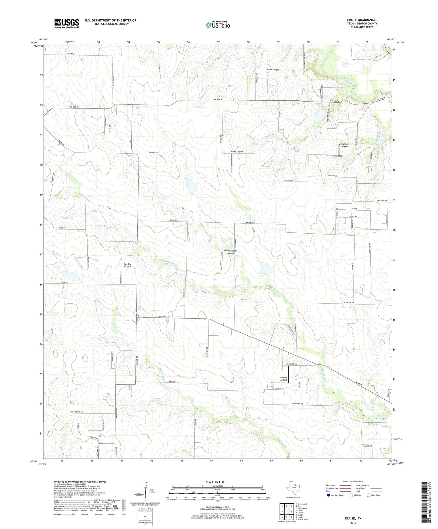
2022 topographic map quadrangle Era SE in the state of Texas. Scale: 1:24000. Based on the newly updated USGS 7.5' US Topo map series, this map is in the following counties: Denton. The map contains contour data, water features, and other items you are used to seeing on USGS maps, but also has updated roads and other features. This is the next generation of topographic maps. Printed on high-quality waterproof paper with UV fade-resistant inks.
Quads adjacent to this one:
West: Slidell
Northwest: Greenwood
North: Era
Northeast: Valley View
East: Sanger
Southeast: Denton West
South: Ponder
Southwest: Bluett
This map covers the same area as the classic USGS quad with code o33097c3.
Contains the following named places: Bird Dog Airfield, Boom Branch, Flying C Airport, Glass Airport, Haire Airport, Plainview, Soil Conservation Service Site 2 Dam, Soil Conservation Service Site 2 Reservoir, Soil Conservation Service Site 4 Dam, Soil Conservation Service Site 4 Reservoir, Soil Conservation Service Site 41 Dam, Soil Conservation Service Site 41 Reservoir, Soil Conservation Service Site 42 Dam, Soil Conservation Service Site 42 Reservoir, Soil Conservation Service Site 7 Dam, Soil Conservation Service Site 7 Reservoir, Stocker Airport, Windmillcreek Airport, ZIP Code: 76249