MyTopo
Green Valley Texas US Topo Map
Couldn't load pickup availability
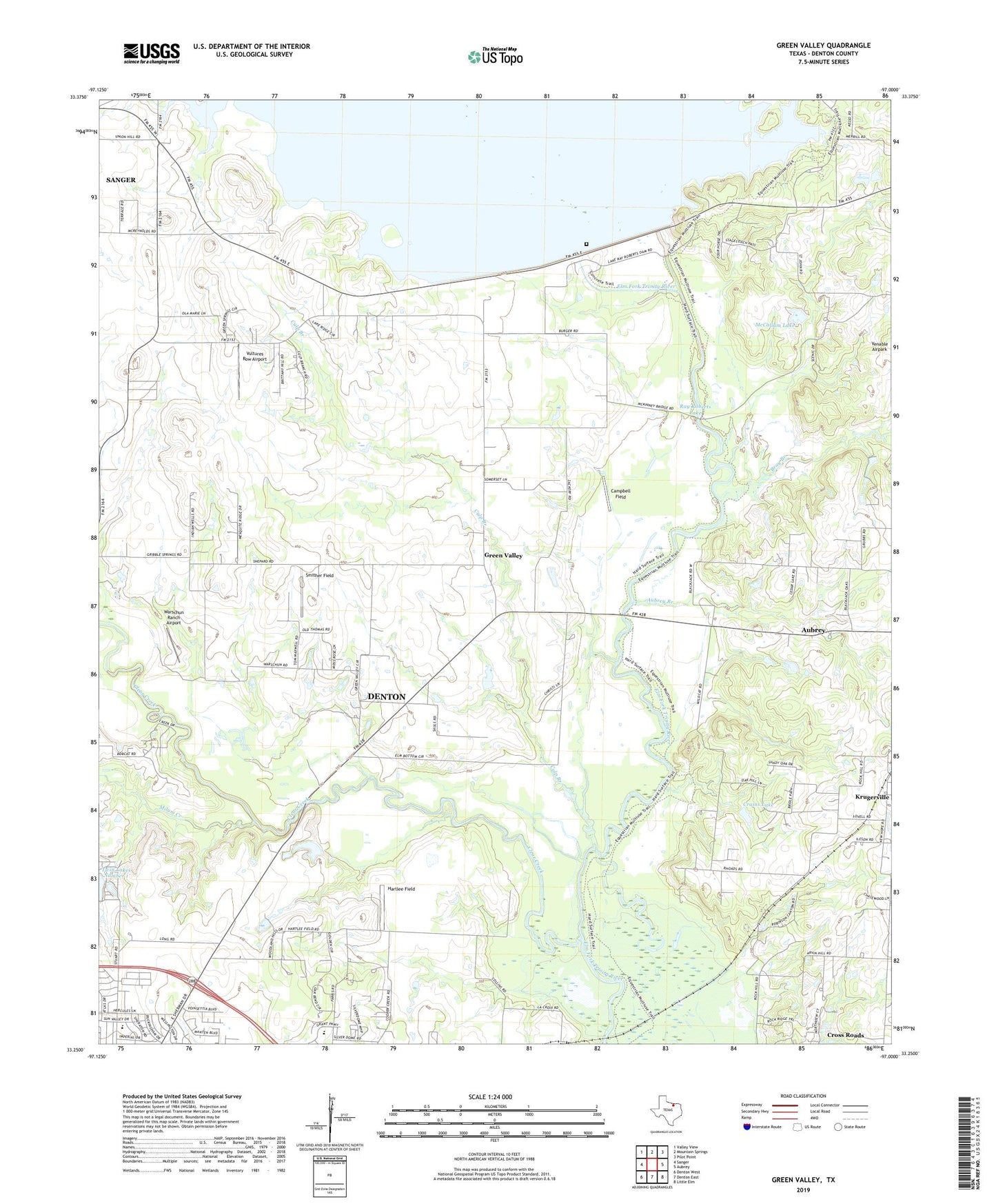
2022 topographic map quadrangle Green Valley in the state of Texas. Scale: 1:24000. Based on the newly updated USGS 7.5' US Topo map series, this map is in the following counties: Denton. The map contains contour data, water features, and other items you are used to seeing on USGS maps, but also has updated roads and other features. This is the next generation of topographic maps. Printed on high-quality waterproof paper with UV fade-resistant inks.
Quads adjacent to this one:
West: Sanger
Northwest: Valley View
North: Mountain Springs
Northeast: Pilot Point
East: Aubrey
Southeast: Little Elm
South: Denton East
Southwest: Denton West
This map covers the same area as the classic USGS quad with code o33097c1.
Contains the following named places: Aubrey Branch, Bray Branch, Campbell Field, Clear Creek, Crains Lake, Culp Branch, Davis Cemetery, Evans Lake, Evans Lake Dam, First Church of the Nazarene, Ginnings Elementary School, Green Valley, Green Valley Cemetery, Harmony Ranch, Hartlee Field, Hodge Elementary School, Isle du Bois Creek, McCallum Lake, McCallum Lake Dam, Milam Creek, Ray Roberts Greenbelt Corridor Trail, Ray Roberts Lake, Ray Roberts Lake State Recreation Area - Culp Branch Unit, Rock Hill Church, Smither Field, Twin Lakes Number 1, Vultures Row Airport, Warschun Ranch Airport, Windy Hill Airport