MyTopo
Van Horn Texas US Topo Map
Couldn't load pickup availability
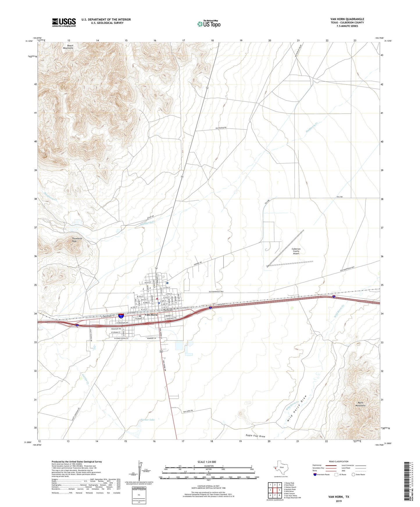
2019 topographic map quadrangle Van Horn in the state of Texas. Scale: 1:24000. Based on the newly updated USGS 7.5' US Topo map series, this map is in the following counties: Culberson. The map contains contour data, water features, and other items you are used to seeing on USGS maps, but also has updated roads and other features. This is the next generation of topographic maps. Printed on high-quality waterproof paper with UV fade-resistant inks.
Quads adjacent to this one:
West: Hackett Peak
Northwest: Sheep Peak
North: Nutt Ranch
Northeast: Watson Ranch
East: Wild Horse
Southeast: Chispa Mountain NW
South: Van Horn Wells
Southwest: Bass Canyon
Contains the following named places: Carrizo Creek, Clark Hotel, Corner Windmill, Culberson County Airport, Culberson County Constable's Office, Culberson County Historic Museum, Culberson County Sheriff's Office, Culberson Hospital, Eagle Elementary School, Eagle Field, Eagle Mountain Academy, Eagle School, Farmer Lake, First Presbyterian Church, Harold Martin Lake Dam, Lipsey Ranch, Neal Ranch, Rivas Park, Texas Department of Public Safety Highway Patrol Office, Threemile Peak, Toolen Field, Town of Van Horn, United States Border Patrol Station, Van Horn, Van Horn Cemetery, Van Horn City Hall, Van Horn Division, Van Horn High School, Van Horn Post Office, Van Horn School