MyTopo
Nutt Ranch Texas US Topo Map
Couldn't load pickup availability
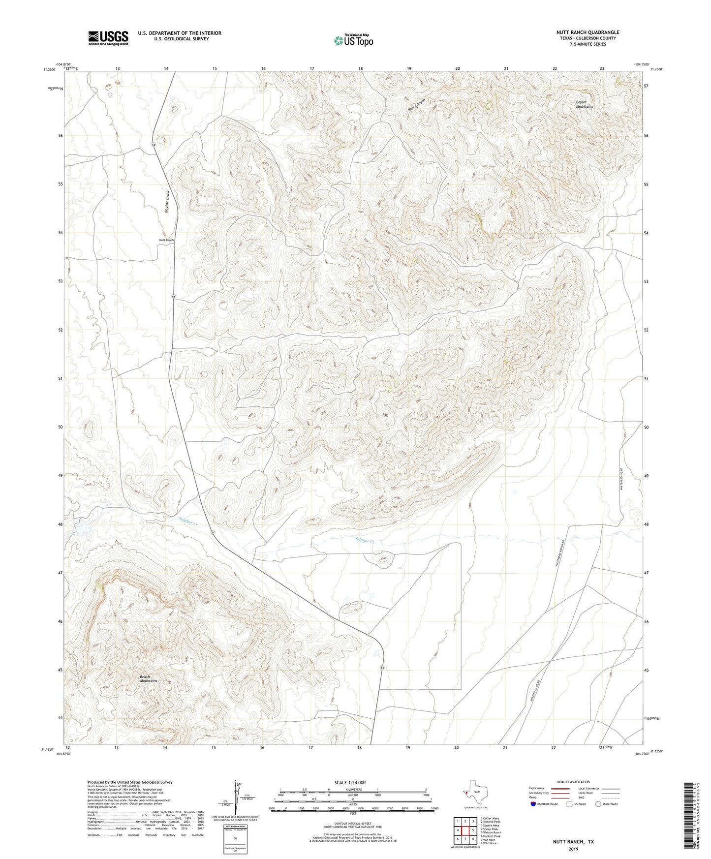
2022 topographic map quadrangle Nutt Ranch in the state of Texas. Scale: 1:24000. Based on the newly updated USGS 7.5' US Topo map series, this map is in the following counties: Culberson. The map contains contour data, water features, and other items you are used to seeing on USGS maps, but also has updated roads and other features. This is the next generation of topographic maps. Printed on high-quality waterproof paper with UV fade-resistant inks.
Quads adjacent to this one:
West: Sheep Peak
Northwest: Collier Mesa
North: Victorio Peak
Northeast: Square Mesa
East: Watson Ranch
Southeast: Wild Horse
South: Van Horn
Southwest: Hackett Peak
This map covers the same area as the classic USGS quad with code o31104b7.
Contains the following named places: Baylor Mountains, Beach Mountains, Nutt Ranch, Puckett Ranch