MyTopo
Sheep Peak Texas US Topo Map
Couldn't load pickup availability
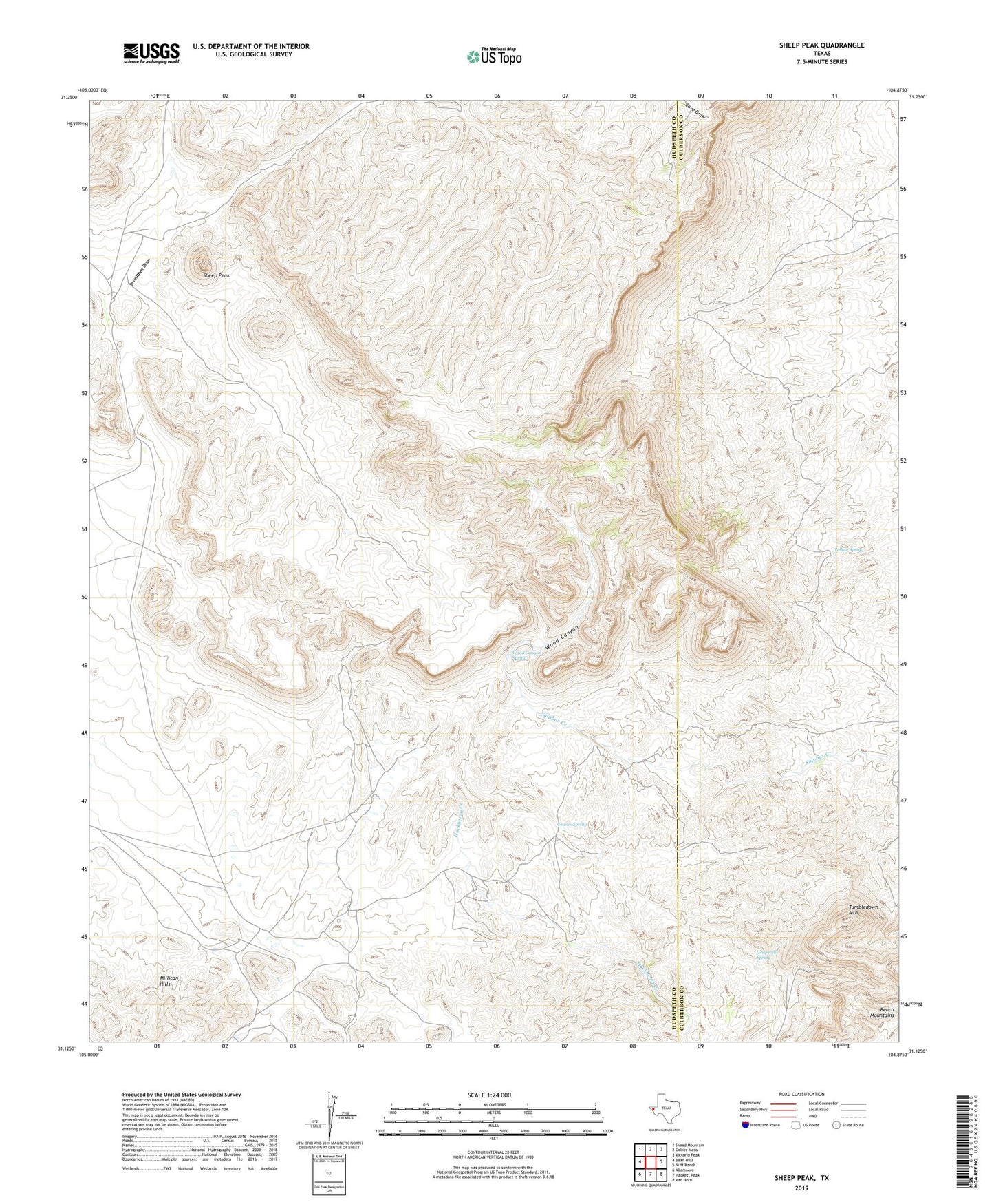
2022 topographic map quadrangle Sheep Peak in the state of Texas. Scale: 1:24000. Based on the newly updated USGS 7.5' US Topo map series, this map is in the following counties: Hudspeth, Culberson. The map contains contour data, water features, and other items you are used to seeing on USGS maps, but also has updated roads and other features. This is the next generation of topographic maps. Printed on high-quality waterproof paper with UV fade-resistant inks.
Quads adjacent to this one:
West: Bean Hills
Northwest: Sneed Mountain
North: Collier Mesa
Northeast: Victorio Peak
East: Nutt Ranch
Southeast: Van Horn
South: Hackett Peak
Southwest: Allamoore
This map covers the same area as the classic USGS quad with code o31104b8.
Contains the following named places: Blackshaft Mine, Circle Ranch, Cowan Spring, Dallas Windmill, Garren Ranch, Grapevine Spring, Grapevine Springs, Hackberry Mine, Hazel Mine, Millican Hills, Mohawk Mine, Saint Elmo Mine, Sancho Panza Mine, Sheep Peak, Sierra Diablo Wildlife Management Area Trail, Tumbledown Mountain, Wood Canyon, Wood Canyon Spring, Yellow Spring