MyTopo
Wild Horse Texas US Topo Map
Couldn't load pickup availability
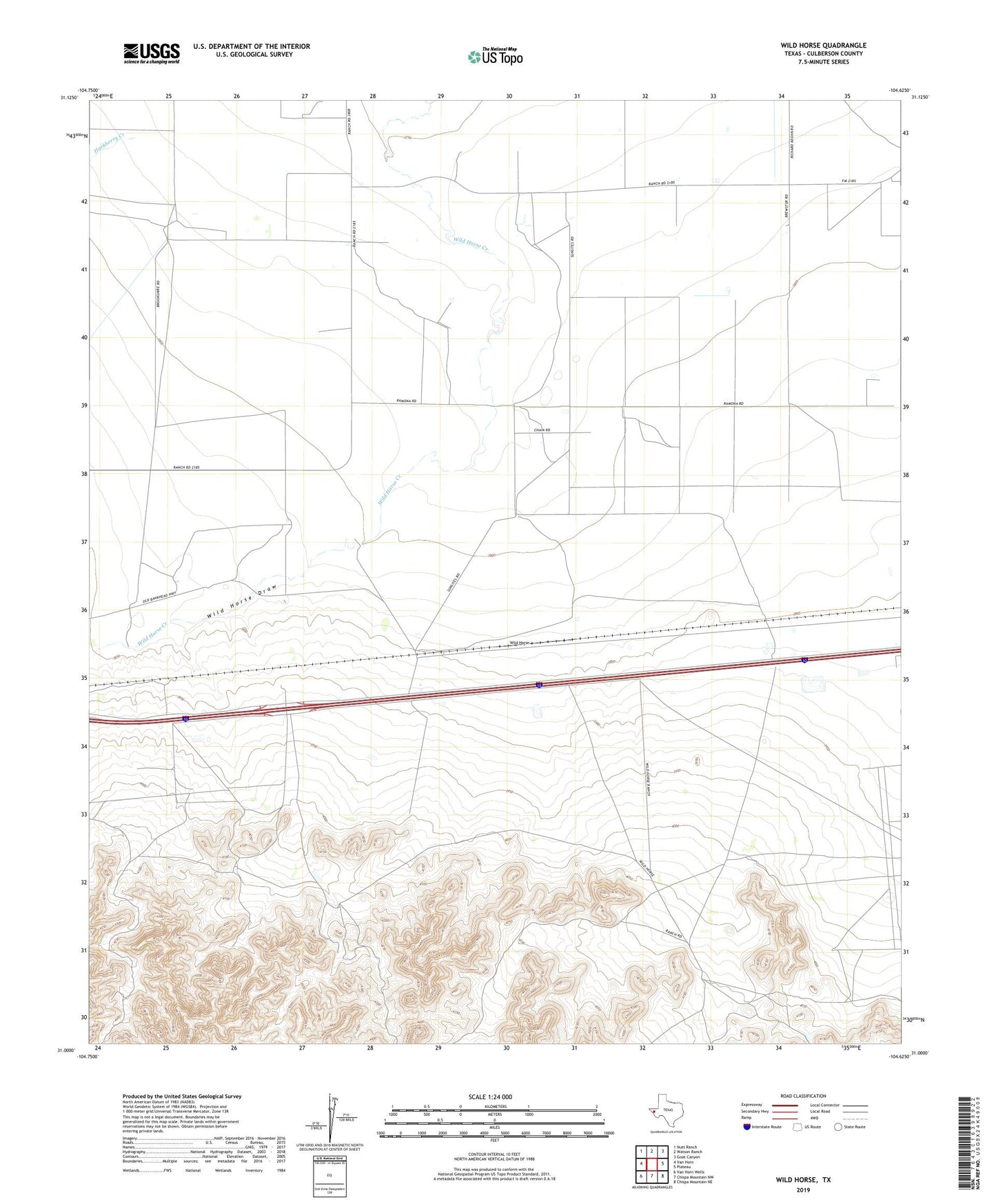
2022 topographic map quadrangle Wild Horse in the state of Texas. Scale: 1:24000. Based on the newly updated USGS 7.5' US Topo map series, this map is in the following counties: Culberson. The map contains contour data, water features, and other items you are used to seeing on USGS maps, but also has updated roads and other features. This is the next generation of topographic maps. Printed on high-quality waterproof paper with UV fade-resistant inks.
Quads adjacent to this one:
West: Van Horn
Northwest: Nutt Ranch
North: Watson Ranch
Northeast: Goat Canyon
East: Plateau
Southeast: Chispa Mountain NE
South: Chispa Mountain NW
Southwest: Van Horn Wells
This map covers the same area as the classic USGS quad with code o31104a6.
Contains the following named places: Durrill Camp, Hackberry Creek, Harper Ranch, Wild Horse