MyTopo
Van Raub Texas US Topo Map
Couldn't load pickup availability
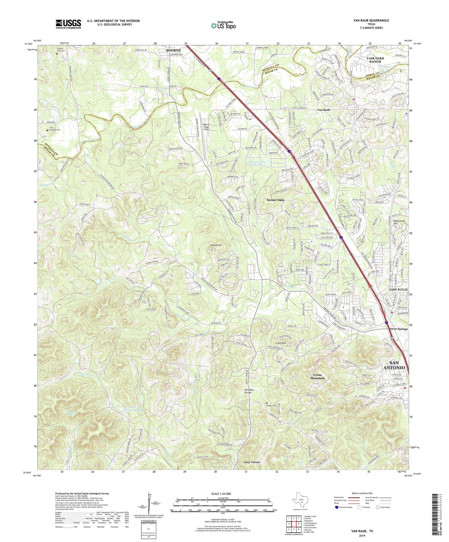
2019 topographic map quadrangle Van Raub in the state of Texas. Scale: 1:24000. Based on the newly updated USGS 7.5' US Topo map series, this map is in the following counties: Bexar, Kendall, Comal. The map contains contour data, water features, and other items you are used to seeing on USGS maps, but also has updated roads and other features. This is the next generation of topographic maps. Printed on high-quality waterproof paper with UV fade-resistant inks.
Quads adjacent to this one:
West: Jack Mountain
Northwest: Ranger Creek
North: Boerne
Northeast: Bergheim
East: Camp Bullis
Southeast: Castle Hills
South: Helotes
Southwest: San Geronimo
Contains the following named places: Aue Stagecoach Inn, Balcones Community Center, Balcones Creek, Boerne Stage Field, Charles Cole Cemetery, City of Fair Oaks Ranch, City of Fair Oaks Ranch Fire Station 2, Cole - Hugman Cemetery, Concept Therapy Institute, Cross Mountain, Cross Mountain Census Designated Place, Cross Mountain Church, Fair Oaks Ranch, Fair Oaks Ranch City Hall, Fair Oaks Ranch Police Department, First Baptist Church of Leon Springs, Friedrich Park, Friedrich Wilderness Park Trail Network, Kremkau Divide, KSAQ-FM (San Antonio), Lakeside Acres Club Lake, Lakeside Acres Club Lake Dam, Leon Springs, Leon Springs Elementary School, Leon Springs Volunteer Fire Department, McFarland Hill, Morales Spring, Pecan Creek, Plehwe Complex, Postoak Creek, Robles Cemetery, Round Hill, Rundale Creek, Saint Elizabeth Ann Seton Catholic Church, San Antonio Fire Department Station 47, Scenic Oaks, Scenic Oaks Census Designated Place, South Lee Cemetery, Tarry Bank Airport, Van Raub, White Company Lake, White Company Lake Dam, ZIP Codes: 78015, 78255