MyTopo
Ranger Creek Texas US Topo Map
Couldn't load pickup availability
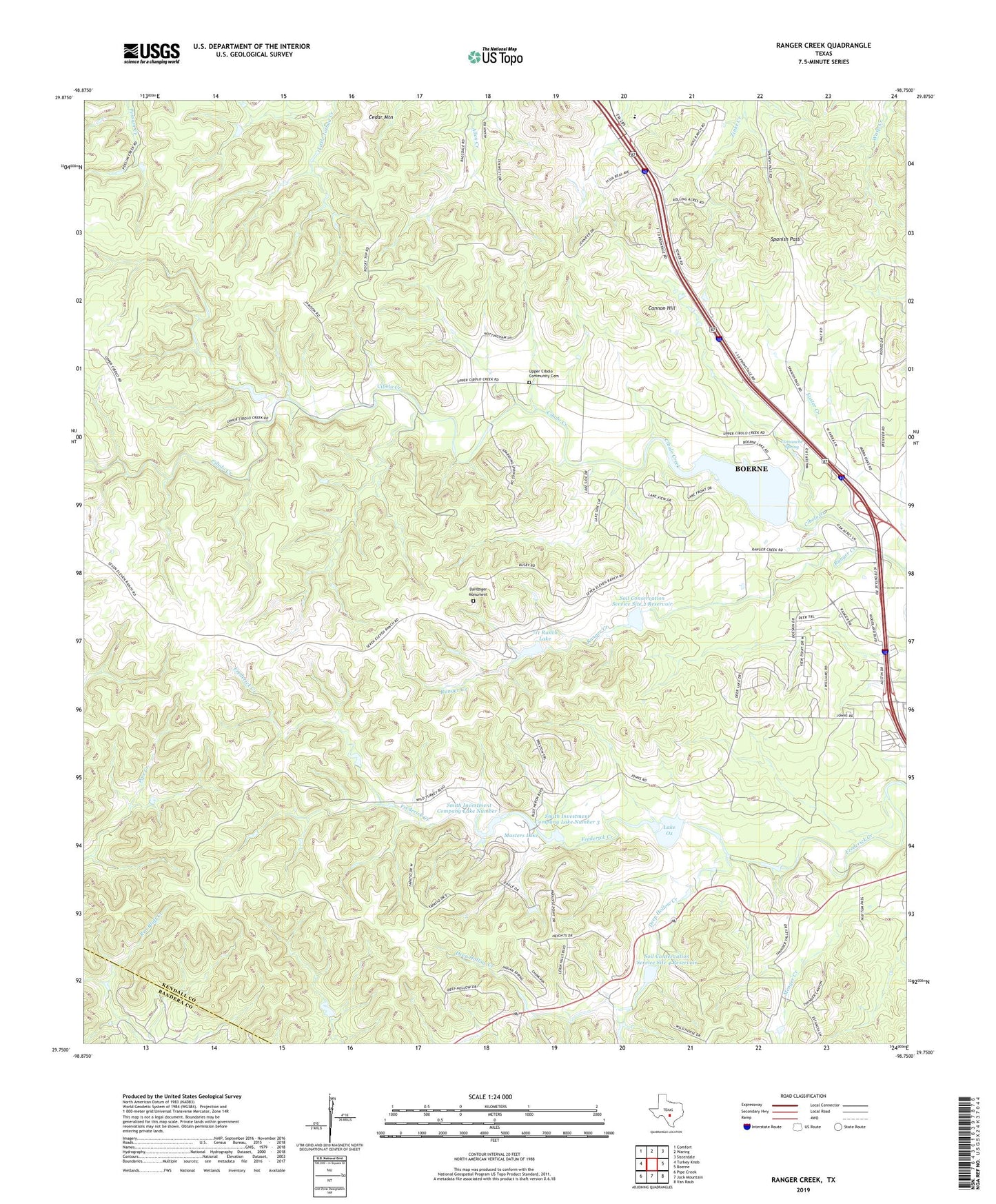
2022 topographic map quadrangle Ranger Creek in the state of Texas. Scale: 1:24000. Based on the newly updated USGS 7.5' US Topo map series, this map is in the following counties: Kendall, Bandera. The map contains contour data, water features, and other items you are used to seeing on USGS maps, but also has updated roads and other features. This is the next generation of topographic maps. Printed on high-quality waterproof paper with UV fade-resistant inks.
Quads adjacent to this one:
West: Turkey Knob
Northwest: Comfort
North: Waring
Northeast: Sisterdale
East: Boerne
Southeast: Van Raub
South: Jack Mountain
Southwest: Pipe Creek
This map covers the same area as the classic USGS quad with code o29098g7.
Contains the following named places: 711 Ranch Lake, 711 Ranch Lake Dam, Agricultural Heritage Museum, Boerne Wastewater Treatment Plant, Cannon Hill, Cedar Mountain, Cibolo Nature Center, Comanche Spring, Dantziger Monument Cemetery, Deep Hollow Creek, Easter Creek, KONO-FM (Fredericksburg), Lake Oz, Lake Oz Dam, Masters Lake, Masters Lake Dam, Ranger Creek, Smith Investment Company Lake Number 1, Smith Investment Company Lake Number 1 Dam, Smith Investment Company Lake Number 3, Smith Investment Company Lake Number 3 Dam, Soil Conservation Service Site 1 Dam, Soil Conservation Service Site 1 Reservoir, Soil Conservation Service Site 2 Dam, Soil Conservation Service Site 2 Reservoir, Soil Conservation Service Site 3 Dam, Soil Conservation Service Site 3 Reservoir, Soil Conservation Service Site 4 Dam, Soil Conservation Service Site 4 Reservoir, Spanish Pass, Sycamore Ridge Camp, Upper Cibolo Community Cemetery