MyTopo
View Texas US Topo Map
Couldn't load pickup availability
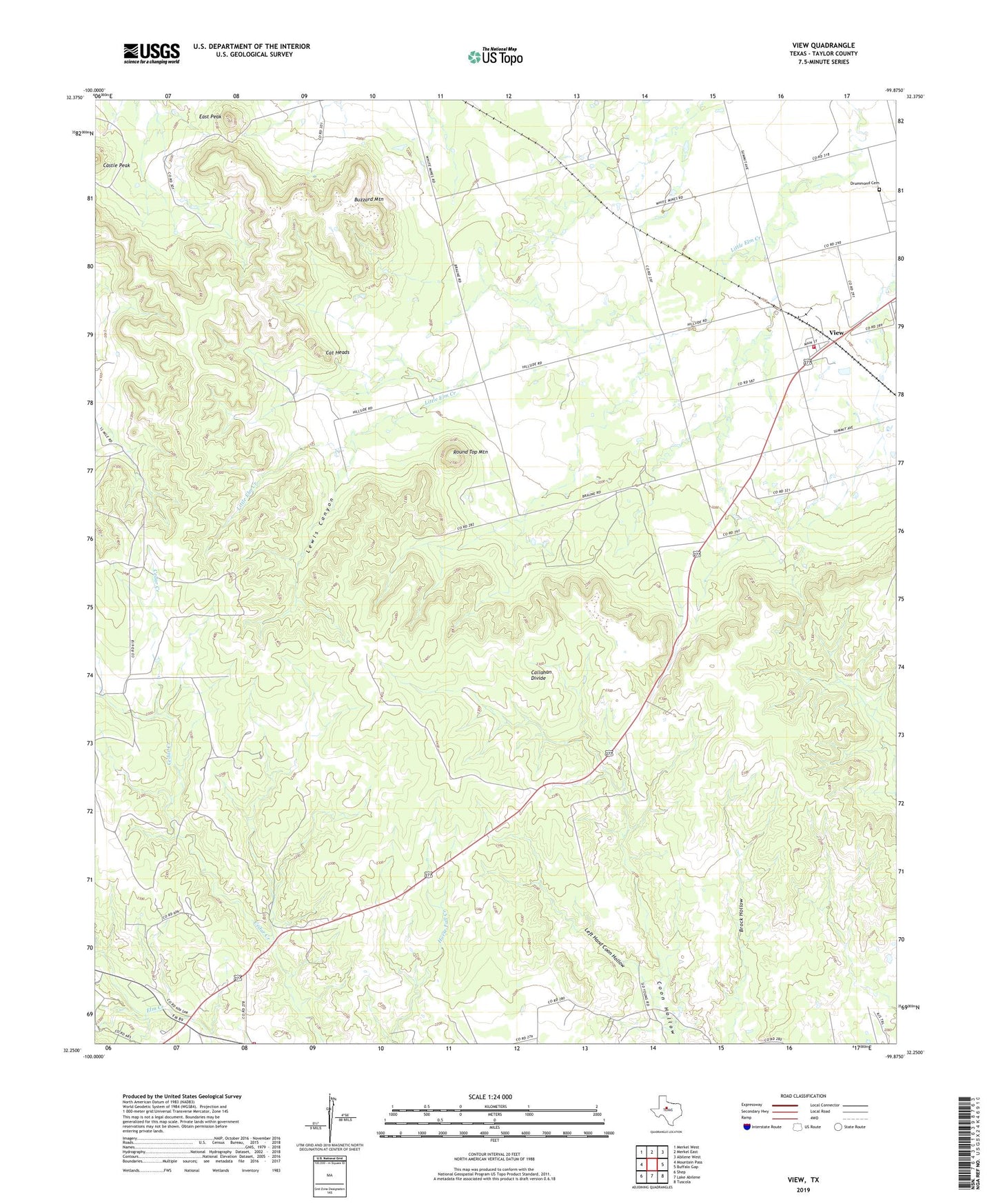
2019 topographic map quadrangle View in the state of Texas. Scale: 1:24000. Based on the newly updated USGS 7.5' US Topo map series, this map is in the following counties: Taylor. The map contains contour data, water features, and other items you are used to seeing on USGS maps, but also has updated roads and other features. This is the next generation of topographic maps. Printed on high-quality waterproof paper with UV fade-resistant inks.
Quads adjacent to this one:
West: Mountain Pass
Northwest: Merkel West
North: Merkel East
Northeast: Abilene West
East: Buffalo Gap
Southeast: Tuscola
South: Lake Abilene
Southwest: Shep
Contains the following named places: Buzzard Mountain, Castle Peak, Cat Heads, Drummond Cemetery, East Peak, Elm Creek Citizens Association Volunteer Fire Department Station 1, KFQX-FM (Merkel), KFXJ-FM (Abilene), Left Hand Coon Hollow, Lewis Canyon, Round Top Mountain, Taylor County, View, View Volunteer Fire Department, ZIP Code: 79603