MyTopo
Waka Texas US Topo Map
Couldn't load pickup availability
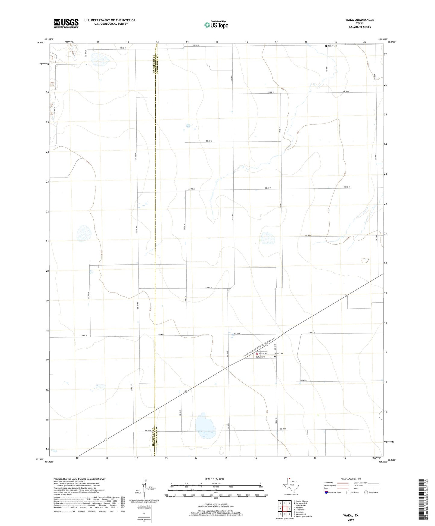
2022 topographic map quadrangle Waka in the state of Texas. Scale: 1:24000. Based on the newly updated USGS 7.5' US Topo map series, this map is in the following counties: Ochiltree, Hansford. The map contains contour data, water features, and other items you are used to seeing on USGS maps, but also has updated roads and other features. This is the next generation of topographic maps. Printed on high-quality waterproof paper with UV fade-resistant inks.
Quads adjacent to this one:
West: Waka SW
Northwest: Hansford Camp
North: Horseshoe Hill
Northeast: Perryton NW
East: Farnsworth
Southeast: Sourdough Creek NW
South: Spearman NE
Southwest: Spearman
This map covers the same area as the classic USGS quad with code o36101c1.
Contains the following named places: Bethel Cemetery, Perryton Fire and Emergency Medical Services Waka Station, Waka, Waka Cemetery, Waka Census Designated Place, ZIP Code: 79093