MyTopo
Wakefield Texas US Topo Map
Couldn't load pickup availability
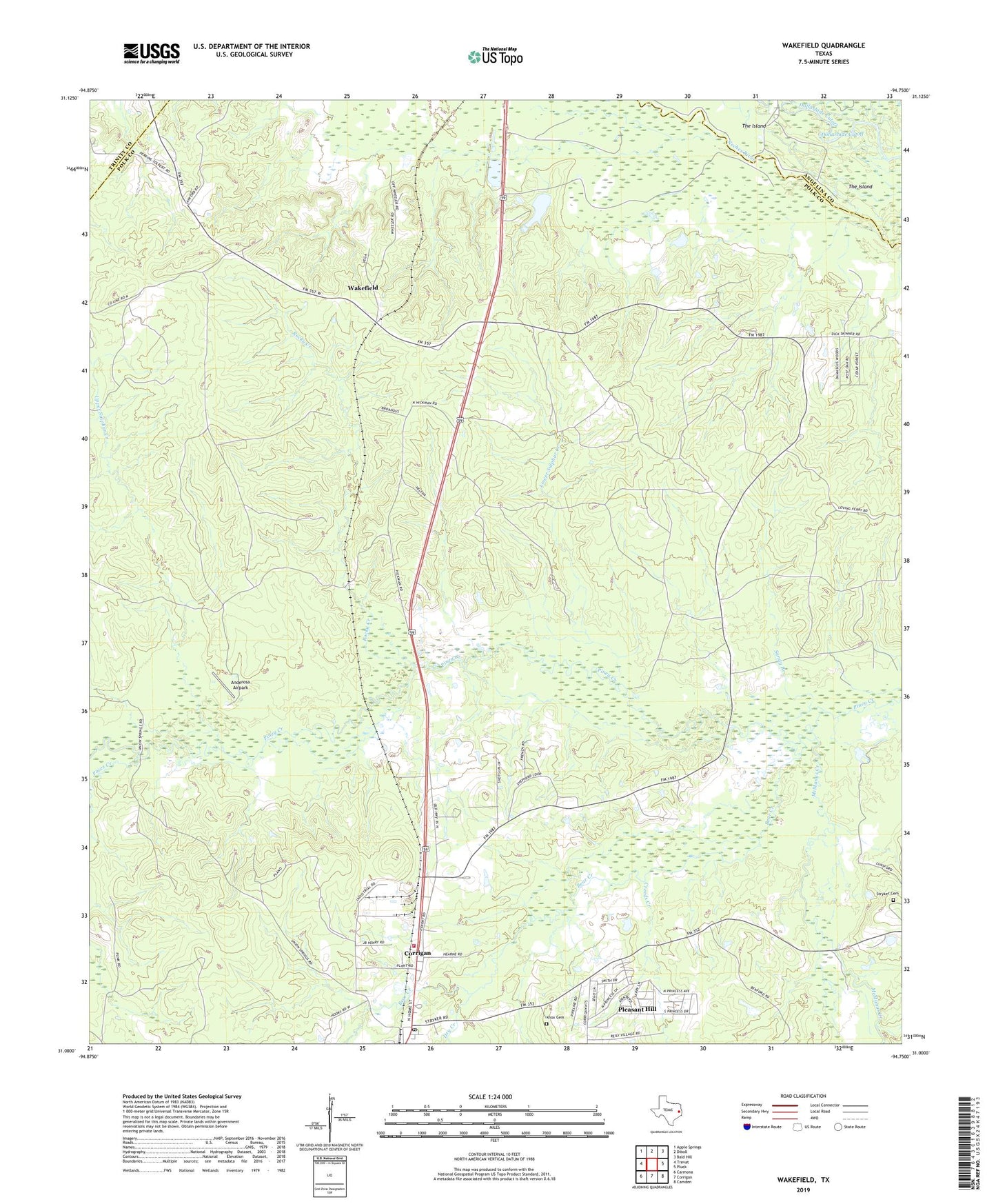
2019 topographic map quadrangle Wakefield in the state of Texas. Scale: 1:24000. Based on the newly updated USGS 7.5' US Topo map series, this map is in the following counties: Polk, Angelina, Trinity. The map contains contour data, water features, and other items you are used to seeing on USGS maps, but also has updated roads and other features. This is the next generation of topographic maps. Printed on high-quality waterproof paper with UV fade-resistant inks.
Quads adjacent to this one:
West: Trevat
Northwest: Apple Springs
North: Diboll
Northeast: Bald Hill
East: Pluck
Southeast: Camden
South: Corrigan
Southwest: Carmona
Contains the following named places: Anderosa Airpark, Bear Creek, Cold Spring Church, Corrigan Division, Corrigan Post Office, Corrigan Volunteer Fire Department, Creeds Creek, Damascus Church, Dollarhide Cutoff, Dry Creek, Knox Cemetery, Lower Sulphur Creek, McManus Creek, Paces Creek, Pleasant Hill, Pleasant Hill Census Designated Place, Rocky Creek, Sandy Branch, Skinner Town, Stovall Creek, Stryker Cemetery, The Island, Upper Sulphur Creek, Wakefield, Wakefield Church, Wakefield Lookout Tower, Wheeler Church, ZIP Code: 75939