MyTopo
Camden Texas US Topo Map
Couldn't load pickup availability
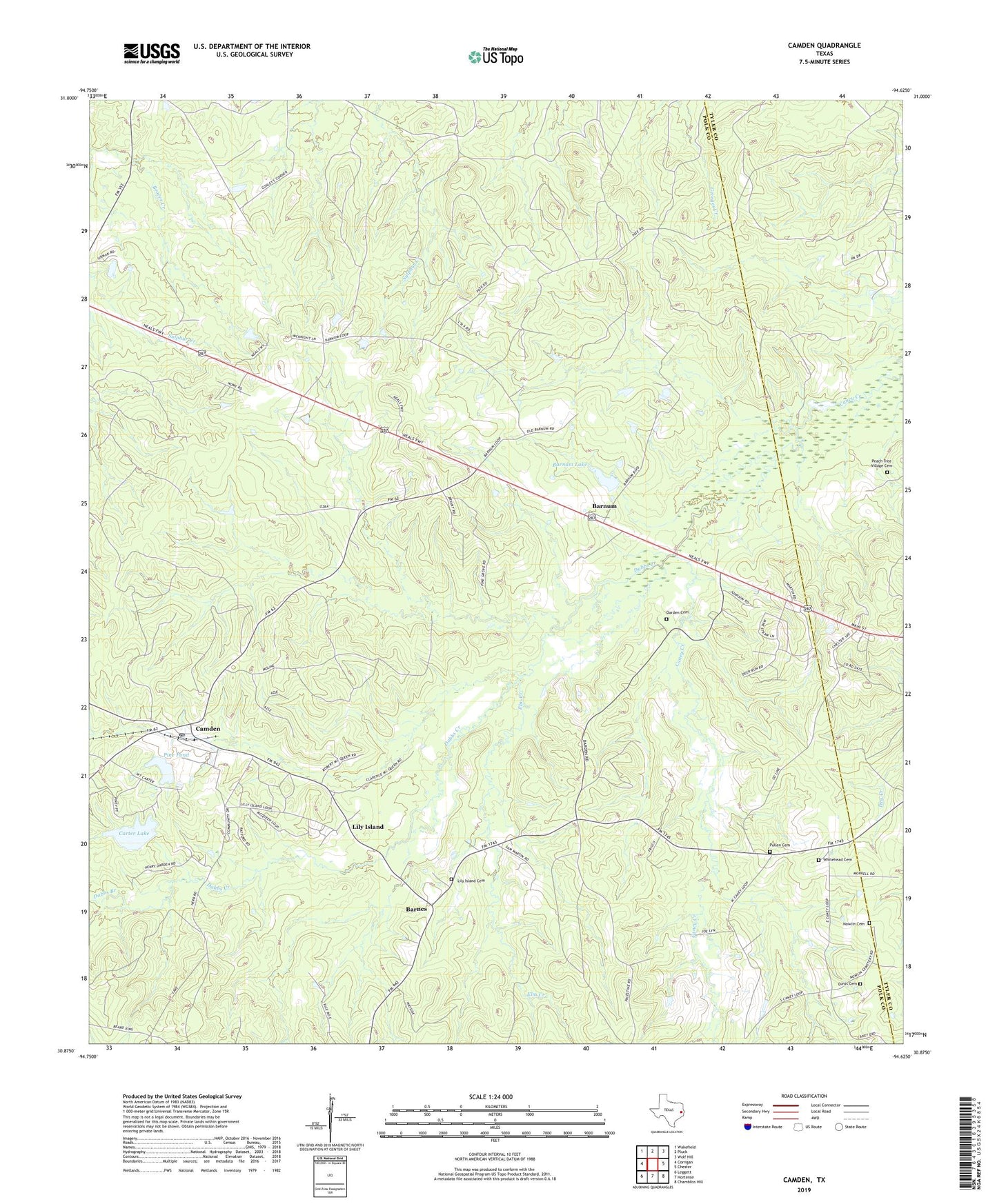
2022 topographic map quadrangle Camden in the state of Texas. Scale: 1:24000. Based on the newly updated USGS 7.5' US Topo map series, this map is in the following counties: Polk, Tyler. The map contains contour data, water features, and other items you are used to seeing on USGS maps, but also has updated roads and other features. This is the next generation of topographic maps. Printed on high-quality waterproof paper with UV fade-resistant inks.
Quads adjacent to this one:
West: Corrigan
Northwest: Wakefield
North: Pluck
Northeast: Wolf Hill
East: Chester
Southeast: Chambliss Hill
South: Hortense
Southwest: Leggett
This map covers the same area as the classic USGS quad with code o30094h6.
Contains the following named places: Barnes, Barnum, Barnum Lake, Barnum Lake Dam, Camden, Camden Post Office, Caney Creek Church, Carter Lake, Carter Lake Dam, Dabbs Branch, Dabbs Creek, Darden Cemetery, Darden Palestine School, Davis Cemetery, Elm Creek, Lily Island, Lily Island Cemetery, Nowlin Cemetery, Old Barnum, Peach Tree Village Cemetery, Pine Grove Church, Pine Pond, Pine Pond Dam, Pullen Cemetery, Whitehead Cemetery