MyTopo
Weir Texas US Topo Map
Couldn't load pickup availability
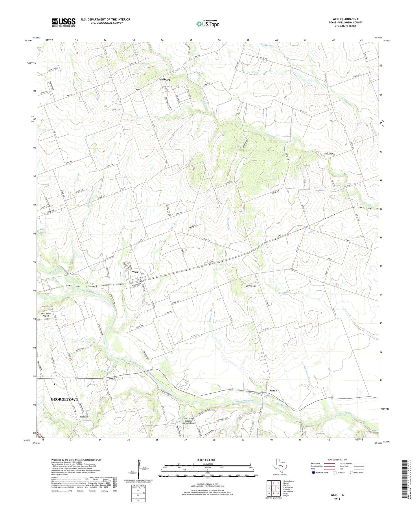
2019 topographic map quadrangle Weir in the state of Texas. Scale: 1:24000. Based on the newly updated USGS 7.5' US Topo map series, this map is in the following counties: Williamson. The map contains contour data, water features, and other items you are used to seeing on USGS maps, but also has updated roads and other features. This is the next generation of topographic maps. Printed on high-quality waterproof paper with UV fade-resistant inks.
Quads adjacent to this one:
West: Georgetown
Northwest: Cobbs Cavern
North: Jarrell
Northeast: Bartlett
East: Granger
Southeast: Taylor
South: Hutto
Southwest: Round Rock
Contains the following named places: Bar 3 Ranch Airport, Berry Creek, Big House Branch, City of Weir, East Fork Ranger Branch, Hoopes Ranch Airport, Jonah, Keelersville, KJWL-FM (Georgetown), Manske Branch Spring, Mileham Branch, Mozo, Palacky School, Pecan Branch, Queen Hill, Ranger Branch, Ranger School, Walburg, Walburg Post Office, Weir, Weir Branch, Weir City Hall, Weir Post Office, Weir Volunteer Fire Department, Williamson County, ZIP Code: 78626