MyTopo
Hutto Texas US Topo Map
Couldn't load pickup availability
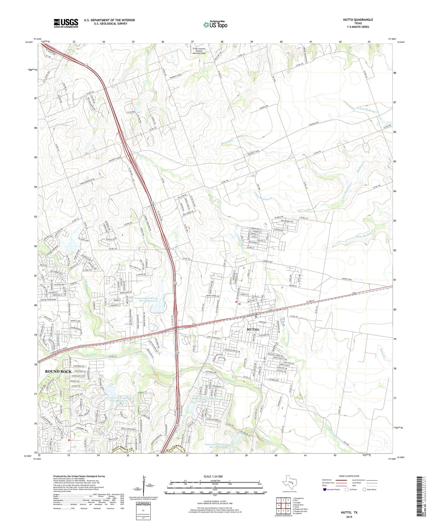
2022 topographic map quadrangle Hutto in the state of Texas. Scale: 1:24000. Based on the newly updated USGS 7.5' US Topo map series, this map is in the following counties: Williamson, Travis. The map contains contour data, water features, and other items you are used to seeing on USGS maps, but also has updated roads and other features. This is the next generation of topographic maps. Printed on high-quality waterproof paper with UV fade-resistant inks.
Quads adjacent to this one:
West: Round Rock
Northwest: Georgetown
North: Weir
Northeast: Granger
East: Taylor
Southeast: Coupland
South: Pflugerville East
Southwest: Pflugerville West
This map covers the same area as the classic USGS quad with code o30097e5.
Contains the following named places: Bell Gin, Chandler Branch, City of Hutto, Cross Country Estates Marshall Field, Forest Creek Elementary School, Hummingbird Heliport, Hutto, Hutto City Hall, Hutto Fire Rescue Williamson County Emergency Services District 3, Hutto Police Department, Hutto Post Office, KRGT-FM (Hutto), McNutt Creek, Montadale School, Old Settlers Park at Palm Valley, Soil Conservation Service Site 15 Dam, Soil Conservation Service Site 15 Reservoir, Soil Conservation Service Site 18 Dam, Soil Conservation Service Site 18 Reservoir, Soil Conservation Service Site 19 Dam, Soil Conservation Service Site 19 Reservoir, Soil Conservation Service Site 20 Dam, Soil Conservation Service Site 20 Reservoir, Soil Conservation Service Site 21 Dam, Soil Conservation Service Site 21 Reservoir, South Fork Mustang Creek, Texas No Name Number 48 Dam, ZIP Code: 78634