MyTopo
Jarrell Texas US Topo Map
Couldn't load pickup availability
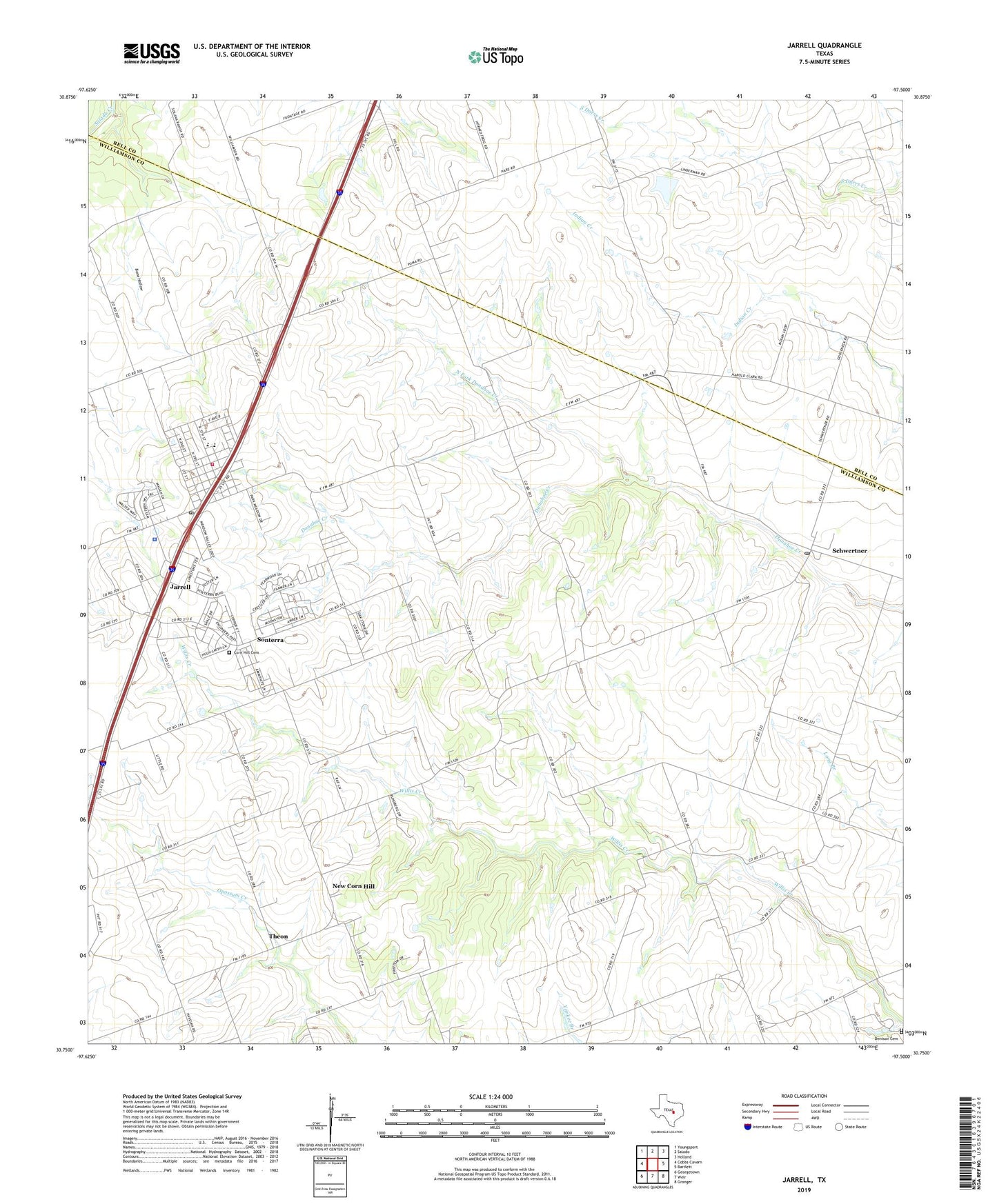
2022 topographic map quadrangle Jarrell in the state of Texas. Scale: 1:24000. Based on the newly updated USGS 7.5' US Topo map series, this map is in the following counties: Williamson, Bell. The map contains contour data, water features, and other items you are used to seeing on USGS maps, but also has updated roads and other features. This is the next generation of topographic maps. Printed on high-quality waterproof paper with UV fade-resistant inks.
Quads adjacent to this one:
West: Cobbs Cavern
Northwest: Youngsport
North: Salado
Northeast: Holland
East: Bartlett
Southeast: Granger
South: Weir
Southwest: Georgetown
This map covers the same area as the classic USGS quad with code o30097g5.
Contains the following named places: Bone Hollow, City of Jarrell, Corn Hill, Corn Hill Cemetery, Denison Cemetery, Holy Trinity School, Jarrell, Jarrell City Hall, Jarrell Division, Jarrell Post Office, Jarrell Volunteer Fire Department, New Corn Hill, North Fork Donahoe Creek, Schwertner, Schwertner Post Office, Sonterra, Sonterra Census Designated Place, Theon, ZIP Codes: 76537, 76573