MyTopo
Wellington Texas US Topo Map
Couldn't load pickup availability
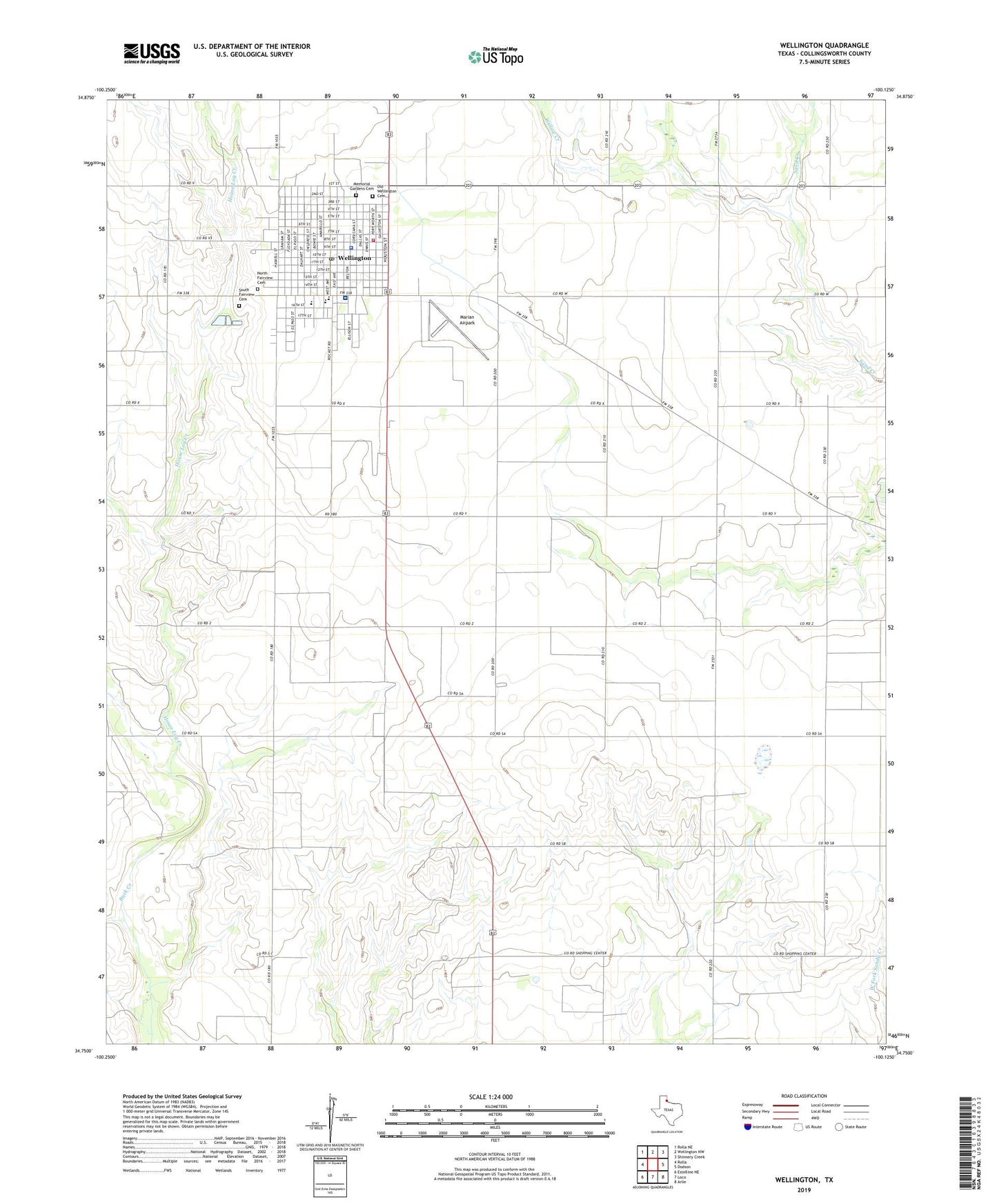
2022 topographic map quadrangle Wellington in the state of Texas. Scale: 1:24000. Based on the newly updated USGS 7.5' US Topo map series, this map is in the following counties: Collingsworth. The map contains contour data, water features, and other items you are used to seeing on USGS maps, but also has updated roads and other features. This is the next generation of topographic maps. Printed on high-quality waterproof paper with UV fade-resistant inks.
Quads adjacent to this one:
West: Rolla
Northwest: Rolla NE
North: Wellington NW
Northeast: Shinnery Creek
East: Dodson
Southeast: Arlie
South: Loco
Southwest: Estelline NE
This map covers the same area as the classic USGS quad with code o34100g2.
Contains the following named places: City of Wellington, Collingsworth County Constable's Office, Collingsworth County Jail, Collingsworth County Museum, Collingsworth County Sheriff's Office, Collingsworth General Hospital, Faith Baptist Church, First Baptist Church, Fresno, Fundamental Baptist Church, House Log, House Log Creek, Lake Atteberry, Marian Airpark, Memorial Gardens Cemetery, North Fairview Cemetery, Old Wellington Cemetery, South Fairview Cemetery, Wellington, Wellington City Hall, Wellington Elementary School, Wellington Emergency Medical Service, Wellington Emergency Medical Services Ambulance 8th Street Station, Wellington High School, Wellington Junior High School, Wellington Post Office, Wellington Volunteer Fire Department, Willow Creek