
MyTopo
Westphalia Texas US Topo Map
Couldn't load pickup availability
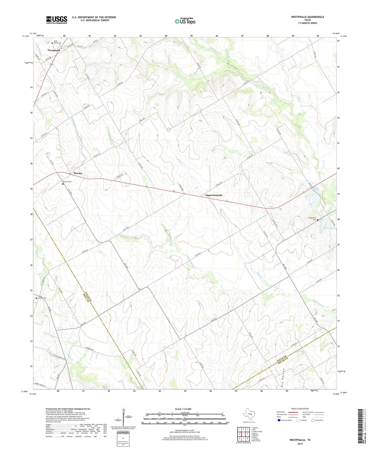
2019 topographic map quadrangle Westphalia in the state of Texas. Scale: 1:24000. Based on the newly updated USGS 7.5' US Topo map series, this map is in the following counties: Falls, Bell, Milam. The map contains contour data, water features, and other items you are used to seeing on USGS maps, but also has updated roads and other features. This is the next generation of topographic maps. Printed on high-quality waterproof paper with UV fade-resistant inks.
Quads adjacent to this one:
West: Seaton
Northwest: Belfalls
North: Lott
Northeast: Cedar Springs
East: Rosebud
Southeast: Ben Arnold
South: Yarrelton
Southwest: Rogers
Contains the following named places: Barclay, Barclay Cemetery, Bluebonnet Cemetery, Brushy Creek, Cactus Branch, City of Rosebud Dam, Keys Creek, Krause Lake, Krause Lake Dam, McLennans Bluff Historical Marker, Rosebud Lake, Saint Joseph Cemetery, Saint Marys Cemetery, Salem Church, Smith Lake, Smith Lake Dam, Terry Chapel, Westphalia, Westphalia Fire Department, Westphalia Rural Historic District, Wilson, Zipperlandville, ZIP Code: 76519


