MyTopo
Cedar Springs Texas US Topo Map
Couldn't load pickup availability
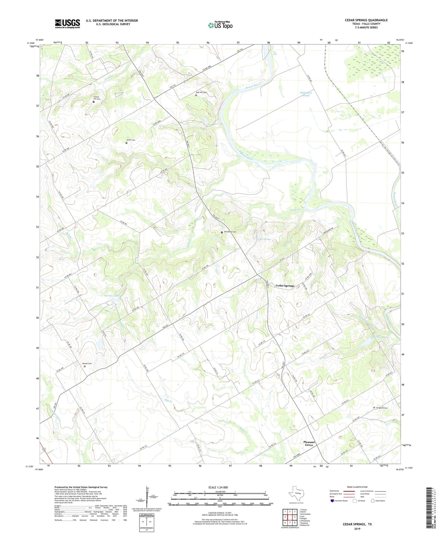
2022 topographic map quadrangle Cedar Springs in the state of Texas. Scale: 1:24000. Based on the newly updated USGS 7.5' US Topo map series, this map is in the following counties: Falls. The map contains contour data, water features, and other items you are used to seeing on USGS maps, but also has updated roads and other features. This is the next generation of topographic maps. Printed on high-quality waterproof paper with UV fade-resistant inks.
Quads adjacent to this one:
West: Lott
Northwest: Chilton
North: Marlin
Northeast: McClanahan
East: Reagan
Southeast: Baileyville
South: Rosebud
Southwest: Westphalia
This map covers the same area as the classic USGS quad with code o31096b8.
Contains the following named places: Bell Branch, Bull Hill Cemetery, Carter Munsch Church, Cedar Springs, Cedar Springs Church, China Grove Church, Cottonwood Branch, Ferguson Cemetery, Gravel Hill Cemetery, Gum Branch, Jerusalem Cemetery, Jerusalem Church, Jones Cemetery, Lake Winiwaca, Lake Winiwaca Dam, Mussel Run Creek, New Salem Church, Pleasant Grove, Poole Creek, Powell Cemetery, Spring Lake, Spring Lake Club Dam, The Falls, Wild Horse Slough