MyTopo
Lott Texas US Topo Map
Couldn't load pickup availability
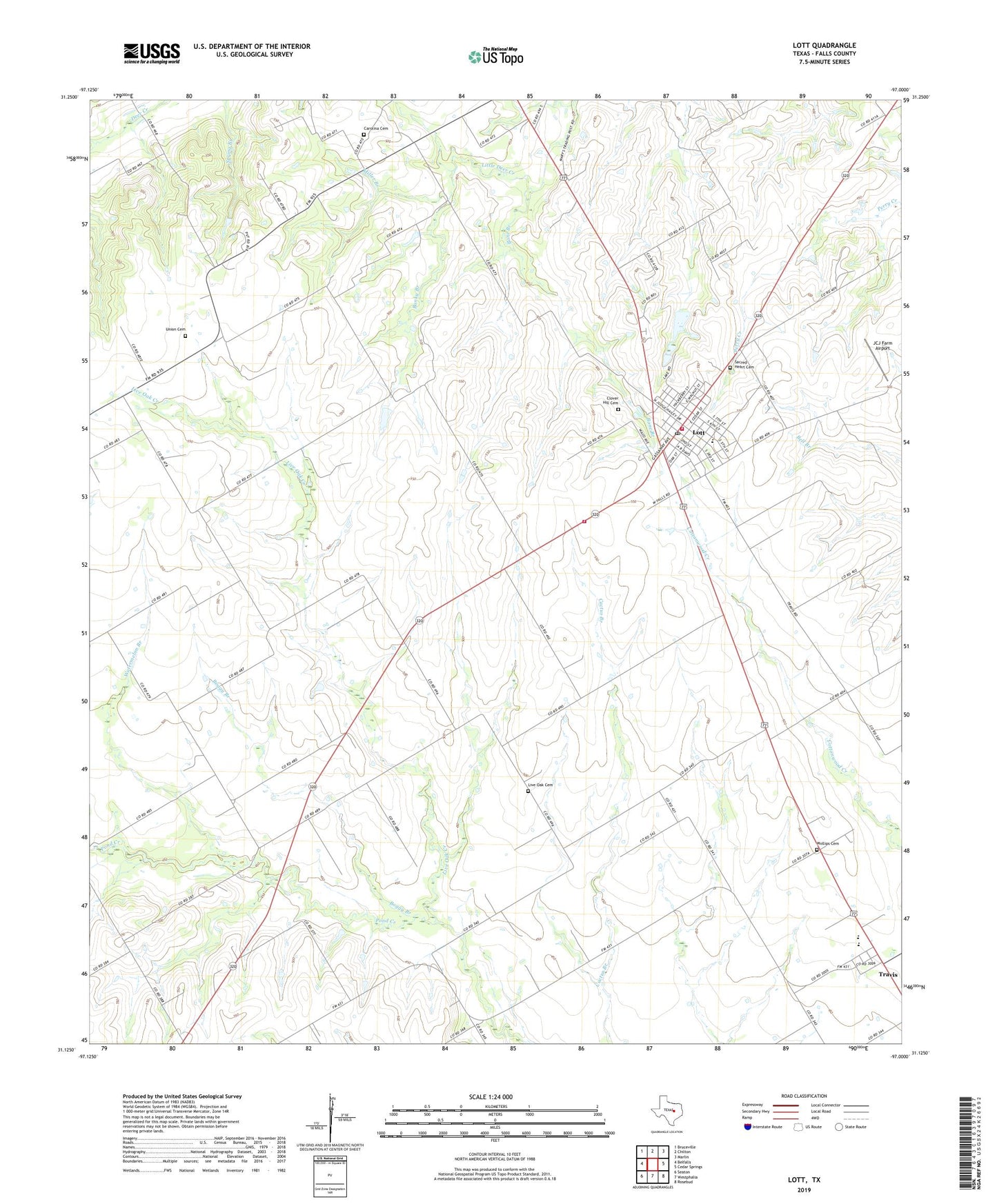
2022 topographic map quadrangle Lott in the state of Texas. Scale: 1:24000. Based on the newly updated USGS 7.5' US Topo map series, this map is in the following counties: Falls. The map contains contour data, water features, and other items you are used to seeing on USGS maps, but also has updated roads and other features. This is the next generation of topographic maps. Printed on high-quality waterproof paper with UV fade-resistant inks.
Quads adjacent to this one:
West: Belfalls
Northwest: Bruceville
North: Chilton
Northeast: Marlin
East: Cedar Springs
Southeast: Rosebud
South: Westphalia
Southwest: Seaton
This map covers the same area as the classic USGS quad with code o31097b1.
Contains the following named places: Banky Branch, Boggy Branch, Bone Branch, Carolina Cemetery, City of Lott, Clover Hill Cemetery, Davis High School, Flanders Field, JCJ Farm Airport, Live Oak Cemetery, Live Oak Creek, Lott, Lott City Marshal, Lott Division, Lott Elementary School, Lott Oil Field, Lott Post Office, Lott Volunteer Fire Department, Miller Branch, Phillips Cemetery, Rosebud-Lott High School, Sacred Heart Cemetery, Travis, Union Cemetery, Watermelon Branch, ZIP Code: 76656