MyTopo
Rogers Texas US Topo Map
Couldn't load pickup availability
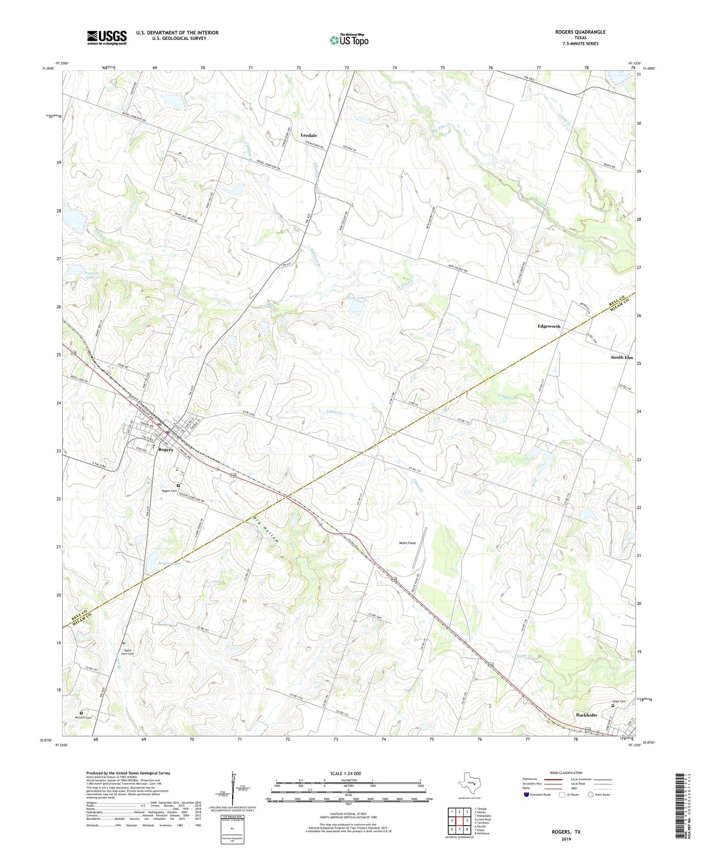
2022 topographic map quadrangle Rogers in the state of Texas. Scale: 1:24000. Based on the newly updated USGS 7.5' US Topo map series, this map is in the following counties: Milam, Bell. The map contains contour data, water features, and other items you are used to seeing on USGS maps, but also has updated roads and other features. This is the next generation of topographic maps. Printed on high-quality waterproof paper with UV fade-resistant inks.
Quads adjacent to this one:
West: Little River
Northwest: Temple
North: Seaton
Northeast: Westphalia
East: Yarrelton
Southeast: Pettibone
South: Sharp
Southwest: Davilla
This map covers the same area as the classic USGS quad with code o30097h2.
Contains the following named places: Bowers, Buckholts Division, Burke School, Cubhunt Branch, Edgeworth, Hope Cemetery, Leedale, McCann Cemetery, New Colony, Prewitt Lake 3, Prewitt Lake 3 Dam, Rogers, Rogers Cemetery, Rogers Elementary School, Rogers High School, Rogers Lake, Rogers Lake Dam, Rogers Middle School, Rogers Police Department, Rogers Post Office, Rogers Volunteer Fire Department First Responders, South Elm, Town of Rogers, Whatley Branch, Wolfe Field, Zane Lake, Zane Lake Dam, ZIP Code: 76569